Search filter
Clear filters
-
- GFZ
- Department 1 Geodesy
- Section 1.1 Space Geodetic Techniques
- Section 1.2 Global Geomonitoring and Gravity Field
- Department 2 Geophysics
- Section 2.2 Geophysical Imaging
- Section 2.3 Geomagnetism
- Section 2.4 Seismology
- Department 3 Geochemistry
- Section 3.1 Inorganic and Isotope Geochemistry
- Section 3.5 Interface Geochemistry
- Department 4 Geosystems
- Section 4.2 Geomechanics and Scientific Drilling
- Section 4.4 Hydrology
-
- Data Management/Data Services
- Electromagnetics
- Geochemistry
- Geochronology
- Geodesy and Gravity
- Geology
- Geomagnetism and Paleomagnetism
- Geophysics
- Geosciences
- Gravimetry
- Laboratory Keywords
- Analytical Methods
- Secondary Ion Mass Spectrometry
- Community-related Keywords
- Trace Element Analyses
- Depth Profiling
- Imaging
- Isotopic Analysis
- Particle Search
- Magnetotellurics
- Natural Hazards
- Radio Occultation
- Satellite Laser Ranging
- Seismology
- Space Geodesy
- Superconducting Gravimetry
MESI Instrument Systems

Science requires a solid database and access to dedicated instruments, laboratories, and data products. GFZ’s Modular Earth Science Infrastructure (MESI) provides essential observations for geosciences. It is thus one backbone of research at GFZ and is also available to users from universities and research institutes. The MESI instrument systems comprise operational services and ground segments for satellite missions (especially GRACE-FO and Swarm), globally distributed station networks for seismology, geodesy (GNSS and gravity), and the magnetic field, state-of-the-art instrument pools for seismology, magnetotellurics, and GNSS as well as support services for ICDP projects including the realisation of borehole physical measurements and specialized analytical laboratories (Secondary ion mass spectrometry, Potsdam Imaging and Spectral Analysis Facilities).
Contact persons: Frederik Tilmann, Benjamin Männel, Sergiy Vorogushyn
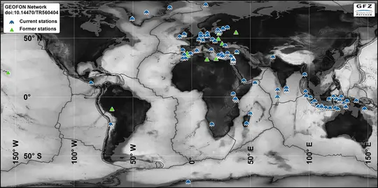
GE Seismic Network - GEOFON Global Seismic Network
In 2018 the GEOFON global seismic network consists of more than 80 active high quality stations with real-time acquisition. The network plays a leading role in global real-time seismology providing valuable data for almost all fundamental and applie…
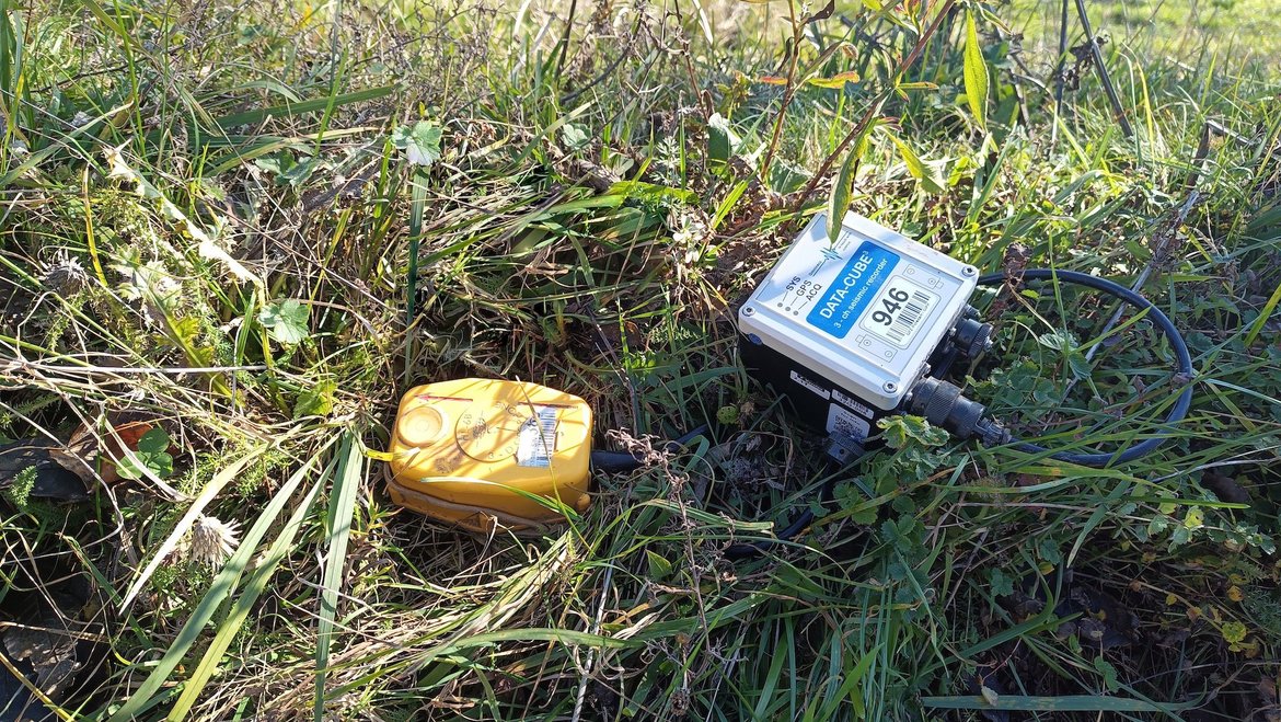
GIPP | Geophysical Instrument Pool Potsdam
The "Geophysical Instrument Pool Potsdam (GIPP)" by GFZ provides seismic, magnetotelluric and geodetic instruments and sensors for projects of GFZ groups, universities and other research facilities. It is hosted by Section 2.2 | Geophysical Imaging …
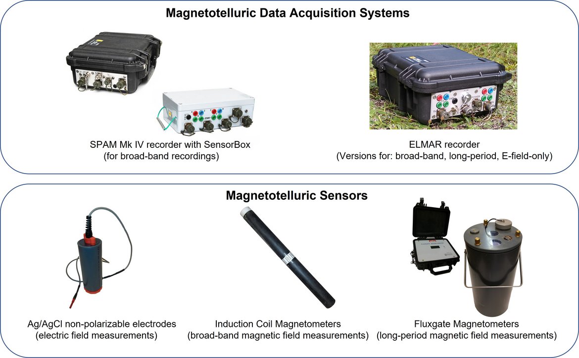
GIPP-MT - Magnetotelluric component of the "Geophysical Instrument Pool Potsdam"
The magnetotelluric instruments are part of the "Geophysical Instrument Pool Potsdam (GIPP)" which means that the instruments are generally available for academic use to all German Universities. The allocation of the instruments is decided by the GF…
GRACE-C - Gravity Recovery and Climate Experiment Continuation Mission
The primary objective of the GRACE-C Mission is, as for GRACE and GRACE-FO, to obtain precise global and high-resolution models for both the static and the time variable components of the Earth's gravity field. As in the original GRACE missions, thi…
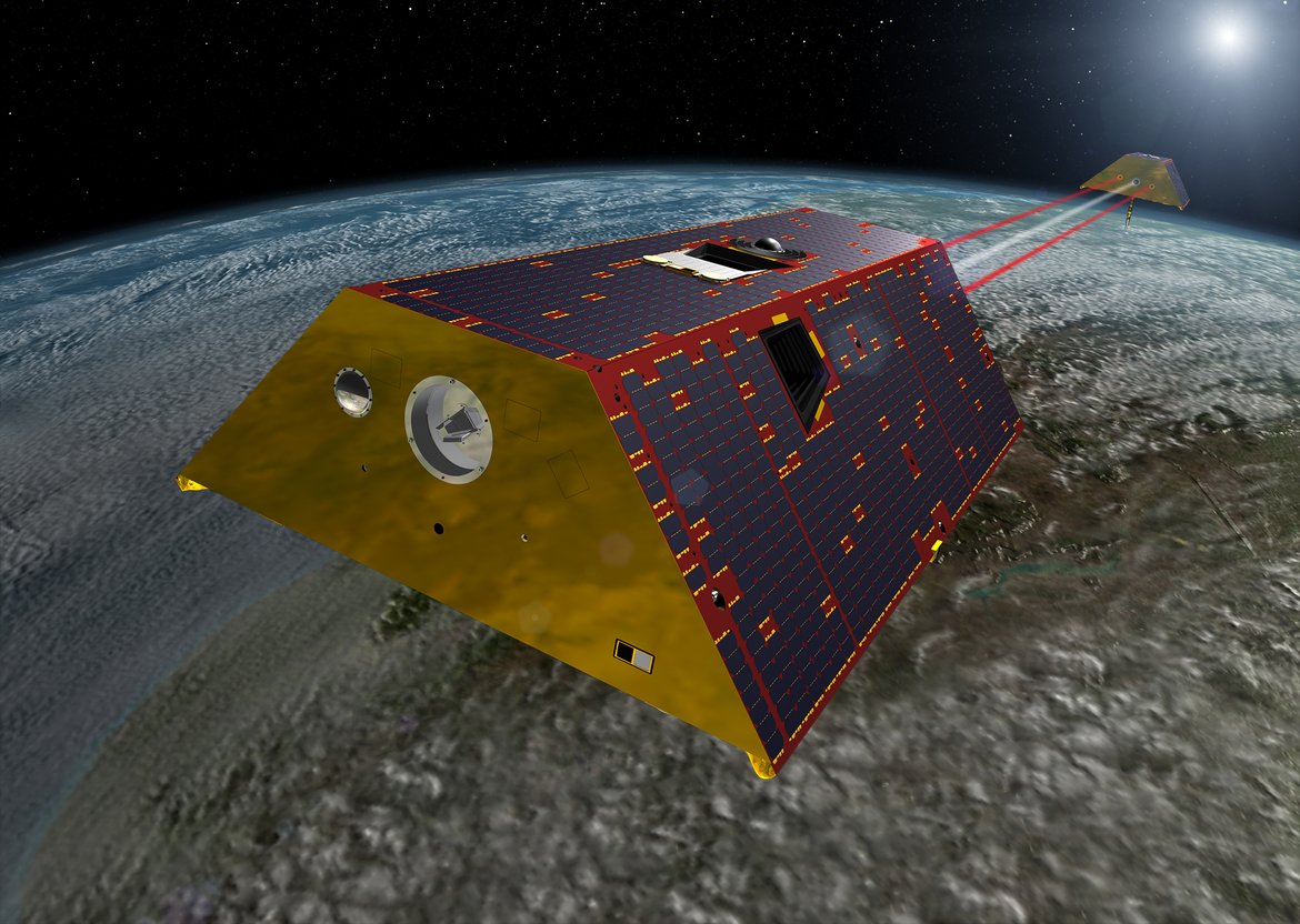
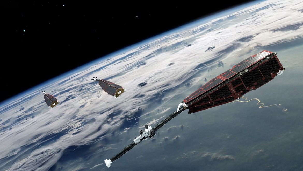
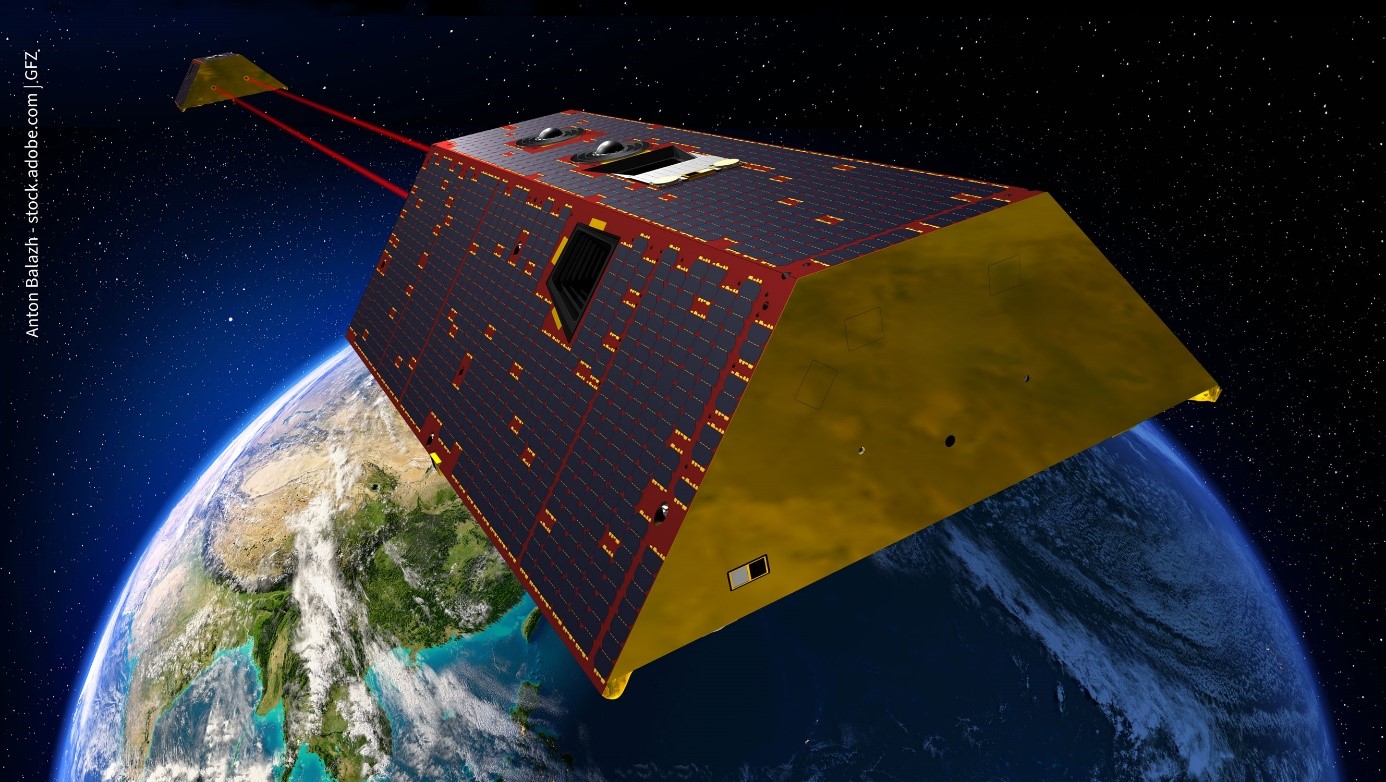
GRACE-FO - Gravity Recovery and Climate Experiment-Follow-On Mission
The primary objective of the GRACE-FO Mission is, as for GRACE, to obtain precise global and high-resolution models for both the static and the time variable components of the Earth's gravity field. As in the original GRACE mission, this goal is ach…
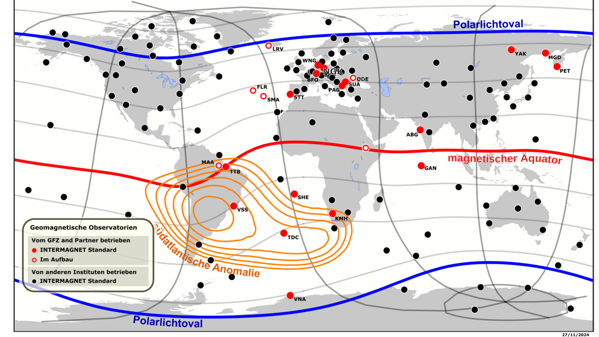

Geomagnetic Observatory Niemegk (NGK)
The Adolf-Schmidt-Observatory for Geomagnetism in Niemegk is operated by GFZ since 1992. It belongs to Section 2.3, Geomagnetism. The observatory is located 50km SW of Potsdam. Since 1930 it continues the measurements, that started in Potsdam in 189…

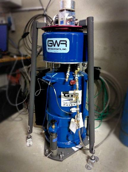
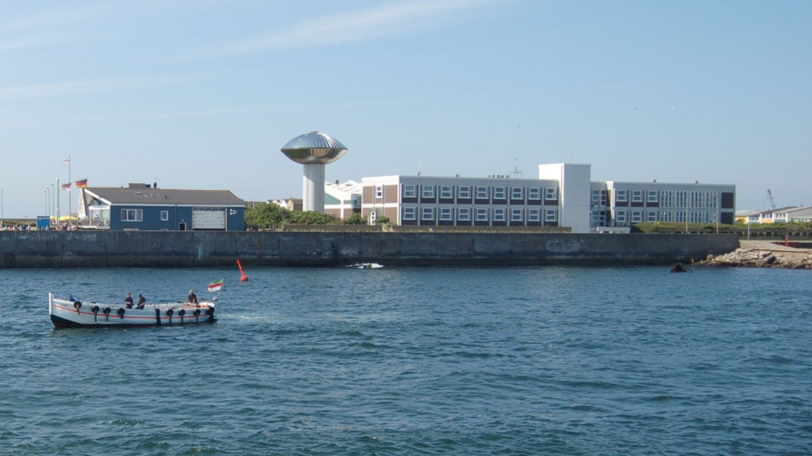
HELGOG - Helgoland Gravimetric Observatory Germany
The Helgoland Gravimetric Observatory Germany (HELGOG) was established in March 2020 in the basement of the Biologische Anstalt Helgoland (BAH) of the Alfred Wegener Institute AWI, Helmholtz Centre for Polar and Marine Research. The main research fo…
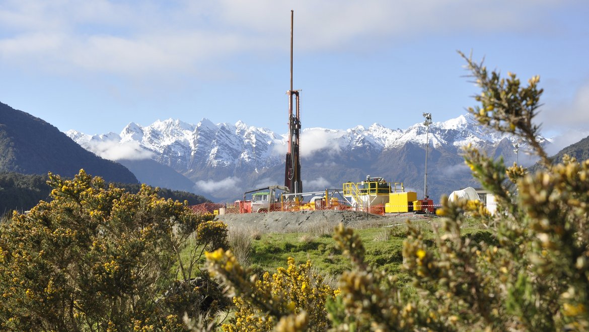
ICDP International Continental Scientific Drilling Programme
The International Continental Scientific Drilling Program (ICDP) is a multinational program to further and fund geosciences in the field of Continental Scientific Drilling. Scientific drilling is a critical tool in understanding of Earth processes a…
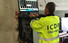
OSG ICDP | Operational Support Group of the International Continental Scientific Drilling Program
The Operational Support Group of the International Continental Scientific Drilling Program, ICDP, situated at GFZ, provides downhole logging services and access to utilize the ICDP instrument pool for PIs of successful ICDP proposals. ICDP is a prop…
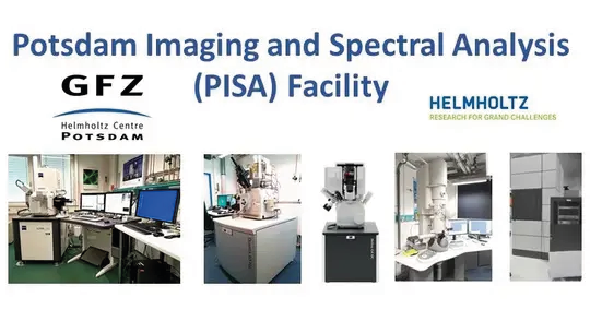
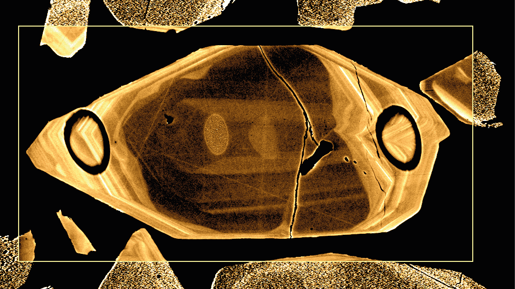
PISA – Potsdam Imaging and Spectral Analysis Facility
The PISA facility combines the state-of-the-art imaging and spectral technologies for all kinds of research applications. It consists of a range of electron microscopes with various detectors including EBSD and EDS, and optical microscopes.
High-re…
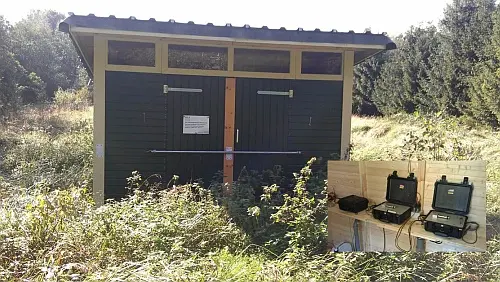
Permanent Magnetotelluric Reference Station in Wittstock, Germany
The sources for the magnetotelluric (MT) method are naturally occurring electromagnetic field variations. Electromagnetic currents are excited over a wide frequency range in the earth’s ionosphere by solar activity and global lighting discharges. Wh…
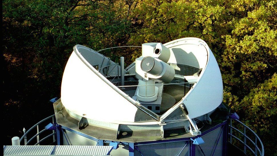

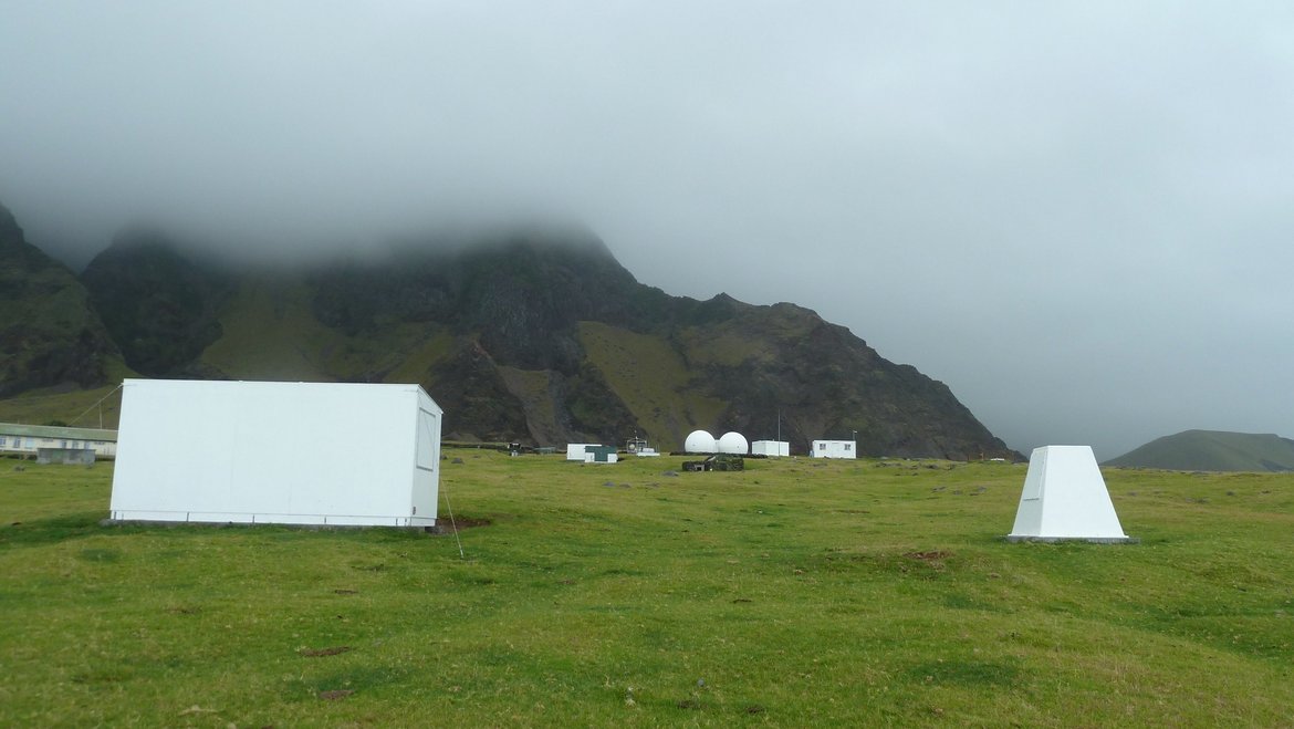
Satellite Receiving Station Ny-Ålesund (Spitsbergen)
The GFZ Helmholtz Centre for Geosciences operates a satellite receiving station at Ny-Ålesund, Spitsbergen (78° 55´ North, 11° 56´ East) to receive data from research satellites in polar orbits. The station is located about 1 km outside the village,…