
ICGEM - International Centre for Global Earth Models
Contact
GFZ Websites
Project Webpage
Data Access via
Infrastructure belongs to
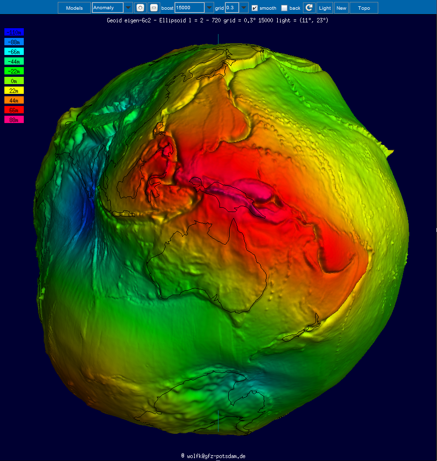
The determination of Earth’s global gravity field is one of the main tasks of geodesy: it serves as a reference for geodesy itself and provides essential information about the Earth, its interior and its fluid envelope for all geosciences. Thus, it is important to model the gravity field globally and make the state-of-the-art models available to public as geodetic products. With accurate satellite measurements, it is now possible to map the static gravity field as well as its variations with much higher spatial and temporal resolutions compared to the first of its kinds. The list of such models is continuously growing and requires dedicated maintenance.
Hosted at GFZ, the International Centre for Global Earth Models (ICGEM) is one of the five services coordinated by the International Gravity Field Service (IGFS) of the International Association of Geodesy (IAG). The primary objective of the ICGEM service is to collect and archive all existing static and temporal global gravity field models and provide an online interactive calculation service for the computation of gravity field functionals freely available to the general public. The calculation of the different functionals of the geopotential (e.g. geoid, gravity anomaly, gravity disturbance, equivalent water height) from a defined global model, on a specified grid or points with respect to a defined reference system, is not trivial for science and scientists and is a responsibility of geodesy too. Additionally, it is important to visualize the spatial and temporal distribution of the global gravity field and therefore interactive visualization is also provided by ICGEM.