Search filter
Clear filters
-
- GFZ
- Department 1 Geodesy
- Section 1.1 Space Geodetic Techniques
- Section 1.2 Global Geomonitoring and Gravity Field
- Section 1.3 Earth System Modelling
- Section 1.4 Remote Sensing and Geoinformatics
- Section 1.5 Space Physics and Space Weather
- Department 2 Geophysics
- Section 2.1 Physics of Earthquakes and Volcanoes
- Section 2.2 Geophysical Imaging
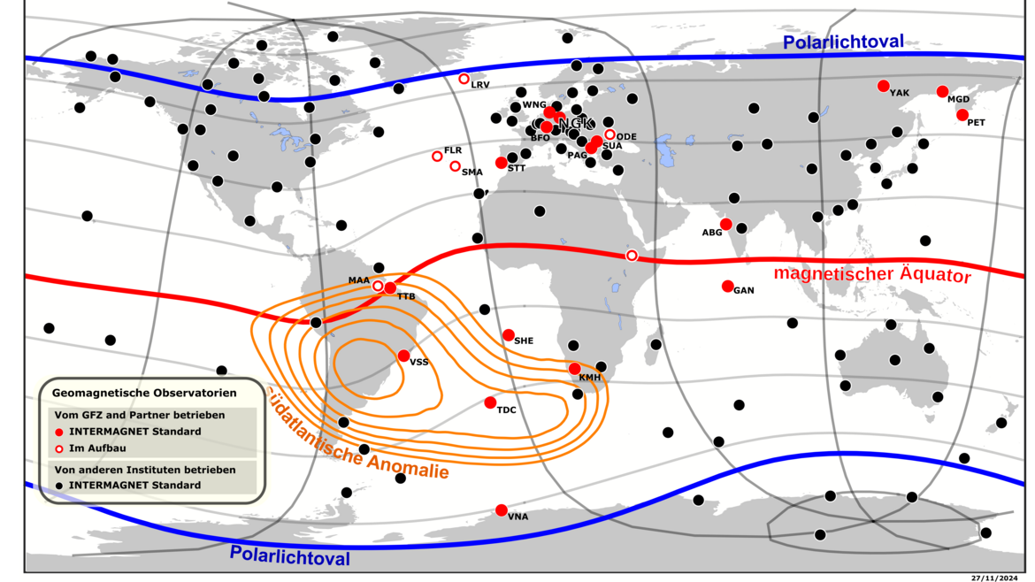
- Section 2.3 Geomagnetism
- Section 2.4 Seismology
- Section 2.6 Seismic Hazard and Risk Dynamics
- Department 4 Geosystems
- Section 4.1 Lithosphere Dynamics
- Section 4.2 Geomechanics and Scientific Drilling
- Section 4.3 Geoenergy
- Section 4.4 Hydrology
- Section 4.6 Geomorphology
- Department 5 Geoinformation
- Section 5.1 Data and Information Management
- Section 5.2 eScience Centre
-
- Archaeomagnetism
- Biogesciences
- Controlled Source Seismology
- Data Management/Data Services
- Earth System Modelling
- Electromagnetics
- Geochemistry
- Geodesy and Gravity
- Geoenergy
- Geology
- Geomorphology
- Geomagnetism
- Geomagnetism and Paleomagnetism
- Geophysics
- Geodynamics
- Geosciences
- Geothermal Energy
- Global Change
- GNSS
- Gravimetry
- Hydrology
- Interdisciplinary
- Biology/Ecosystems Science
- Biogeochemistry
- Life Sciences
- Magnetotellurics
- Meteorology
- Natural Hazards
- Palaeomagnetism
- Paleoclimate
- Paleogeosciences
- Physical Properties of Rocks
- Remote Sensing
- Risks
- Satellite Laser Ranging
- Sedimentology
- Seismic Hazard
- Seismology
- Space Geodesy
- Space Weather
- Tectonophysics
- Volcanology
-
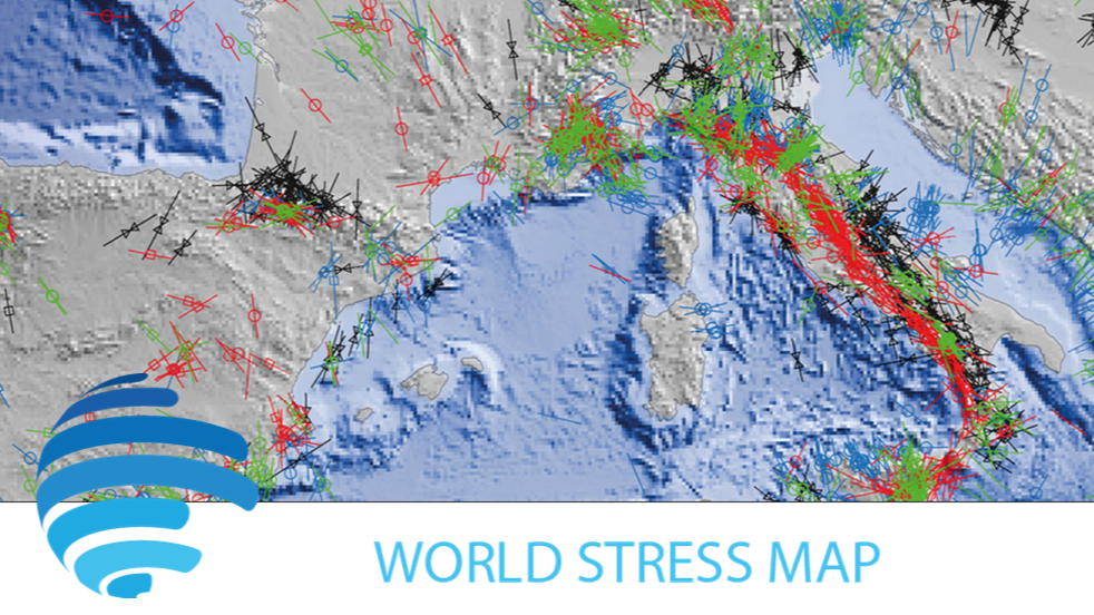
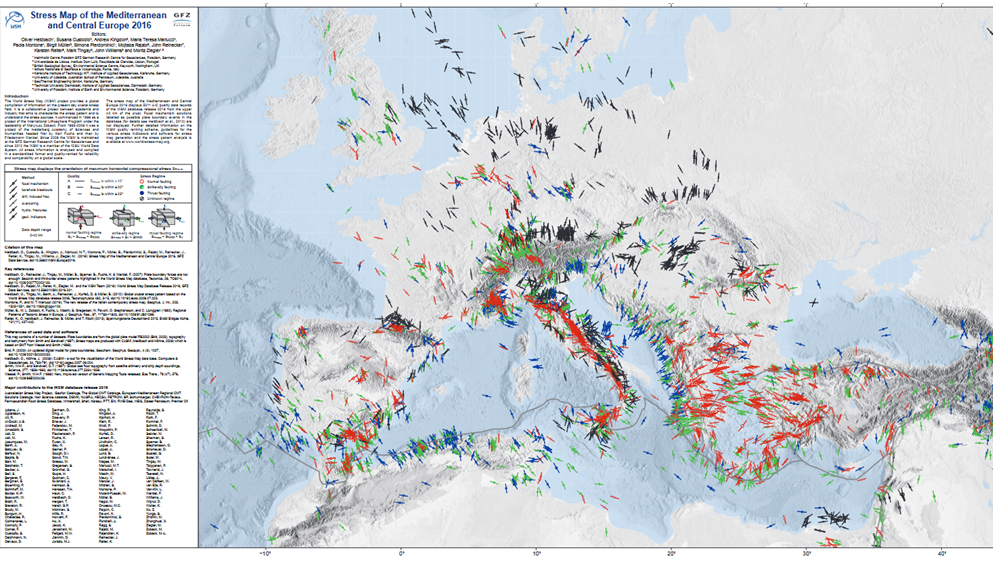
- Contemporary Crustal Stress
- Continuous GNSS Data
- Continuous GNSS Derived Products
- Controlled Source Seismological Data
- Earth Magnetic Field Data
- Earth Orientation Parameters
- Electromagnetic Data
- Final Products
- Geomagnetic Field Models
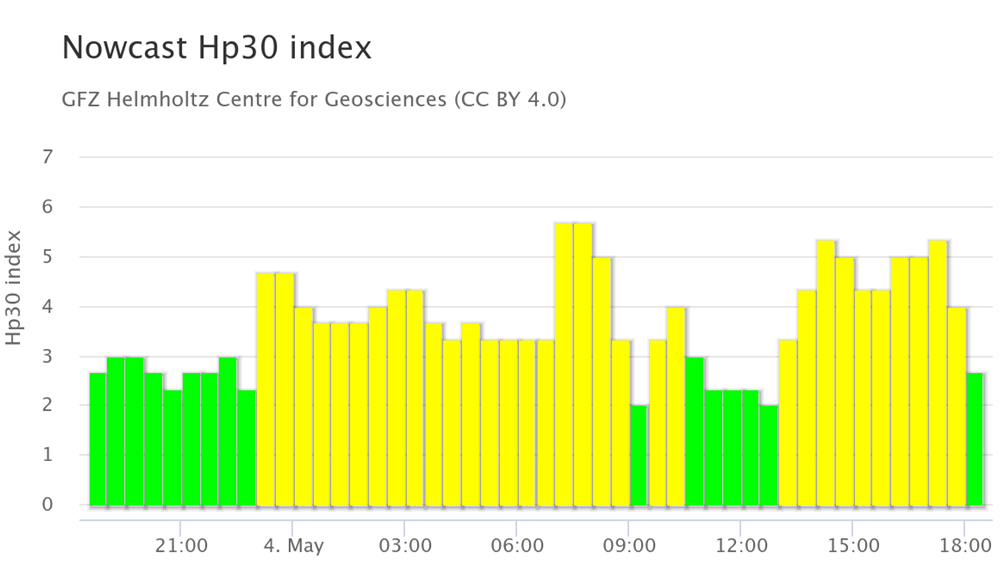
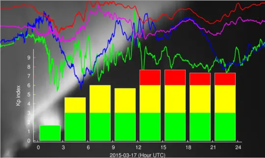
- Geomagnetic index
- Global Gravitational Models
- GNSS Data
- GNSS Station and Satellite Metadata
- Heat Flow Data
- Historical Earthquakes
- Magnetic Data
- Magnetotelluric Data
- Model
- Observation Data and Derived Products for the Global Navigation Satellite Systems (GNSS)
- Passive Seismological Data
- Polar Motion
- Precession/Nutation
- Precise Station Coordinates
- Processed GPS Products
- Rapid Products
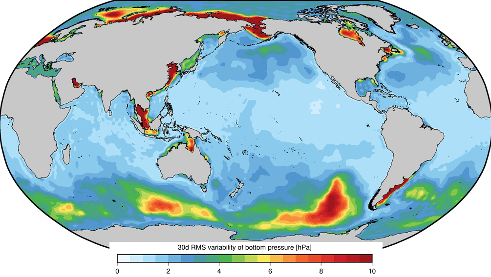
- Raw Gravity and Local Pressure Records and Products
- Satellite Clock Corrections
- Satellite Data
- Satellite Orbits
- Seismic Events
- Temporal Models
- Topography Related Models
- Ultra-rapid Products
- Universal Time
Data Systems

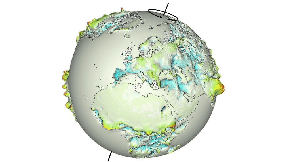
We refer to the data products and data services developed and provided at the GFZ as data systems. (image source: Fachi et al., 2016: The New World Atlas of Artificial Night Sky Brightness, https://doi.org/10.5880/GFZ.1.4.2016.001, Licence: CC BY NC 4.0).
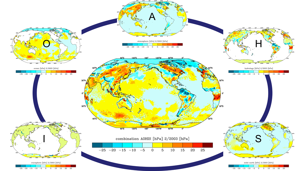
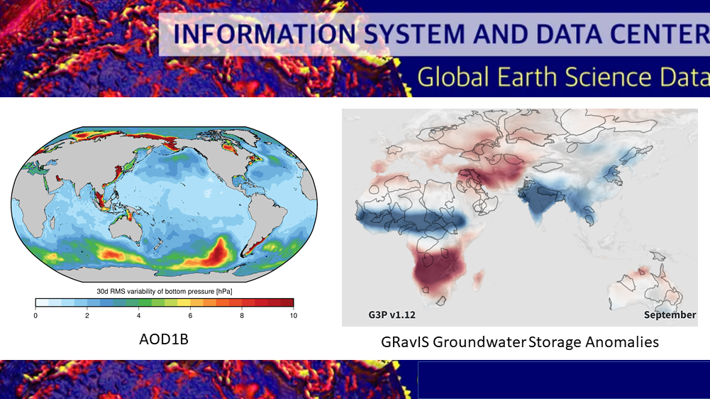
AOD1B - GRACE Atmosphere and Ocean De-Aliasing Level 1B Product
The Atmosphere and Ocean De-Aliasing Level-1B (AOD1B) Product provides a priori information about temporal variations in the Earth's gravity field due to global mass variability in the Atmosphere and ocean. It is based on analysis and forecast data …
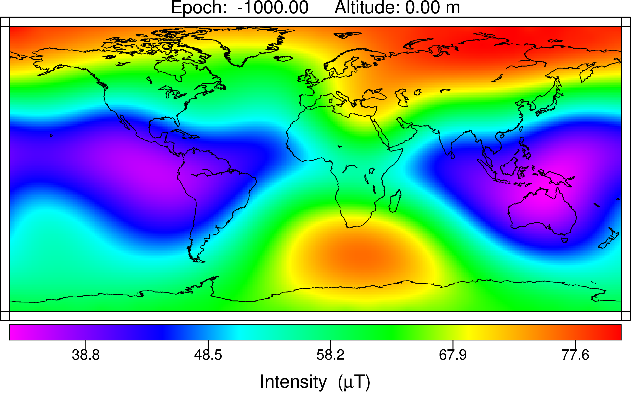
ArchKalmag14k - Correlation based model of the holocene core field, based on archeomagnetic and volcanic data
ArchKalmag14k is constructed using methods from Bayesian statistics, in particular Gaussian processes and the Kalman filter, to reflect uncertainties in data and modeling. Additionally to the field coefficients, covarianz matrices and a model ensemb…
Atmospheric and Hydrospheric Surface Loading Deformations
GFZ provides surface loading products including vertical and horizontal deformations of the crust imposed by surface loading of geophysical fluids in Atmosphere, oceans, and the continental hydrosphere. Products are provided with a spatial resolutio…

CALSxk (10.000 - 3.000 years BP) - Geomagnetic field model for the period 10.000 - 3.000 years BP
Geomagnetic field models of the last 3 to 10 kyrs based on archeo- and paleomagnetic data. This updated version of geomagnetic field description for the past 10 000 years is mainly based on the same data as CALS10k.1b. However, the model offers high…
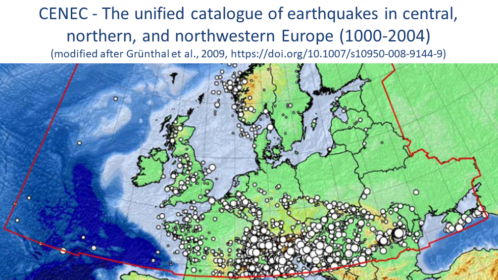
CENEC 2008 - Mw based Earthquake Catalogue for Central, Northern and Northwestern Europe
The unified catalogue of earthquakes in central, northern, and northwestern Europe: Grünthal et al. (2009) published a catalogue for central, northern, and northwestern Europe with unified Mw for events with Mw ≥ 3.5 in the time frame 1000-2004. Thi…
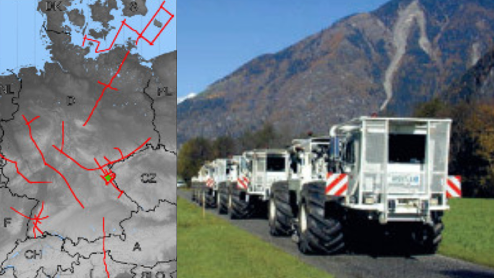
DEKORP - German Continental Seismic Reflection Program
DEKORP (Deutsches Kontinentales Reflexionsseismisches Programm) was carried out between 1984 - 1997 as the German national reflection seismic program funded by the Federal Ministry of Education, Science and Technology (BMFT), now Federal Ministry of…

EAM - Atmospheric and Hydrospheric Earth Rotation Excitations
The GFZ contributes to the Global Geophysical Fluid Center (GGFC) of the International Earth Rotation and Reference Systems Service (IERS) by providing matter and motion terms of effective angular momentum functions (EAM). EAMs are due to mass trans…
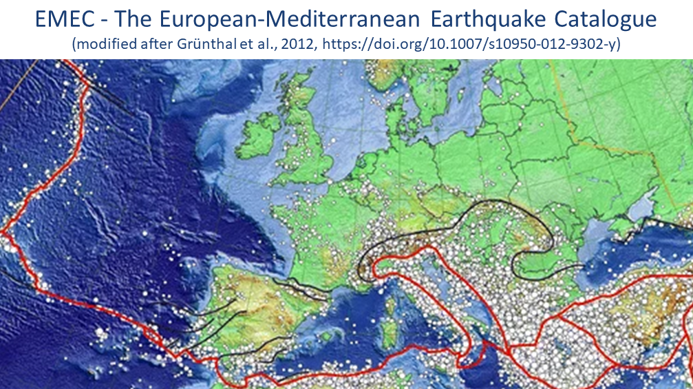
EMEC - The European-Mediterranean Earthquake Catalogue (Version 2021 and earlier versions)
EMEC-2021 is a catalogue of tectonic earthquakes for the broader Mediterranean area, harmonised into a single magnitude scale, Mw (Lammers, Steffi et al., 2023). It is an extended version of “The European-Mediterranean Earthquake Catalogue (EMEC) fo…
ESA ESM - the updated ESA Earth System Model for Gravity Mission Simulation Studies
The ESA ESM is a synthetic model of the time-variable gravity field of the Earth suitable for satellite gravity mission simulation studies. The model is an update of the ESA Earth System Model as described by Gruber et al. (2011), and is also given …
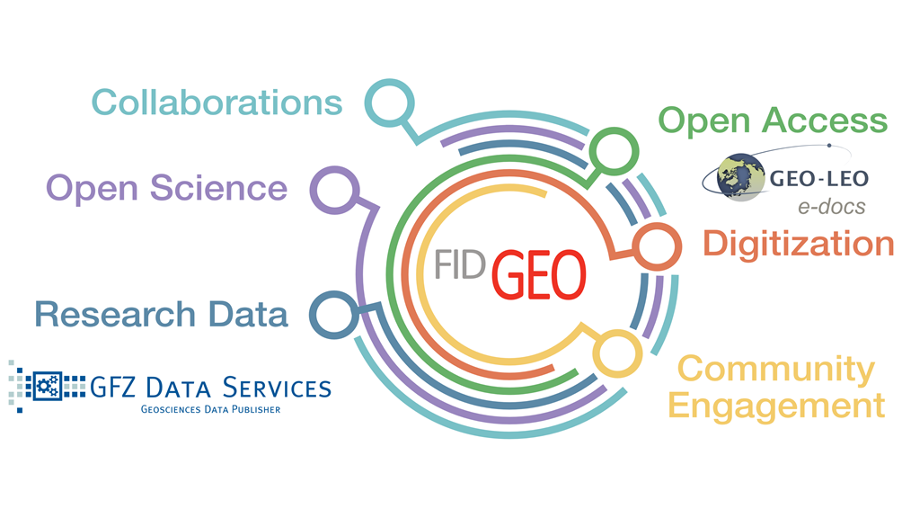
FID GEO - Specialised Information Service Geosciences
The Specialised Information Service for Geosciences (FID GEO - Fachinformationsdienst Geowissenschaften) is an information service of the GFZ Helmholtz Centre for Geosciences in Potsdam (GFZ) and the Goettingen State and University Library. Funded b…
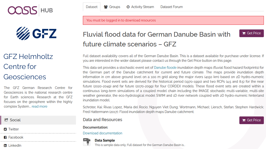
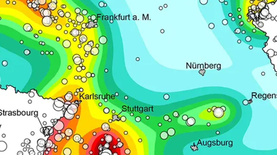
Fluvial inundation maps for the German Danube basin with future climate scenarios
This data set provides a stochastic event set of flood inundation depth maps (fluvial flood hazard footprints) for the German part of the Danube catchment for current and future climate in GEOTIFF format..
The maps provide inundation depth informati…

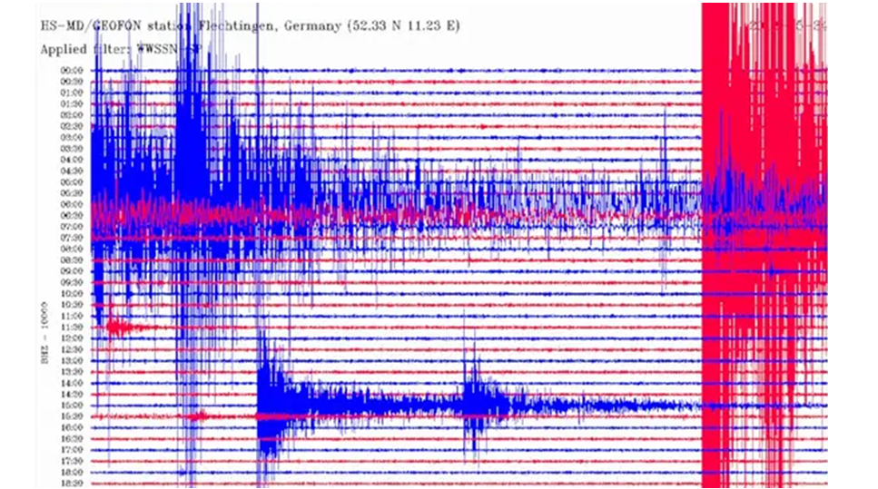
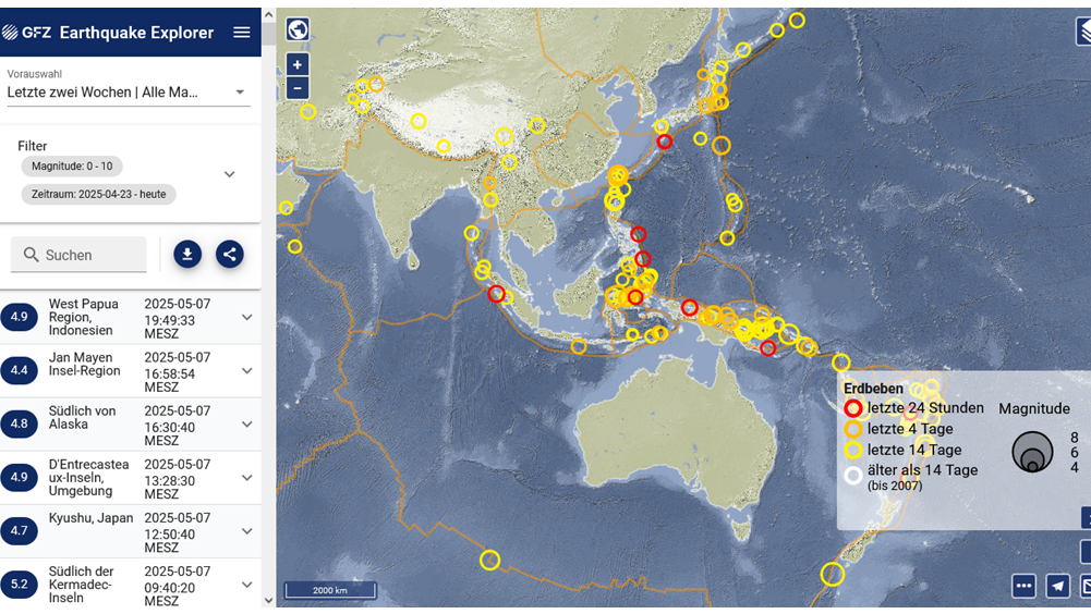
GEOFON Eqinfo - GEOFON Global Earthquake Monitoring System
All real time data streams from GEOFON stations as well as around 900 additional real-time stations from international partners are used to determine rapid automatic location estimates for all globally recorded earthquakes and most regional ones. Th…
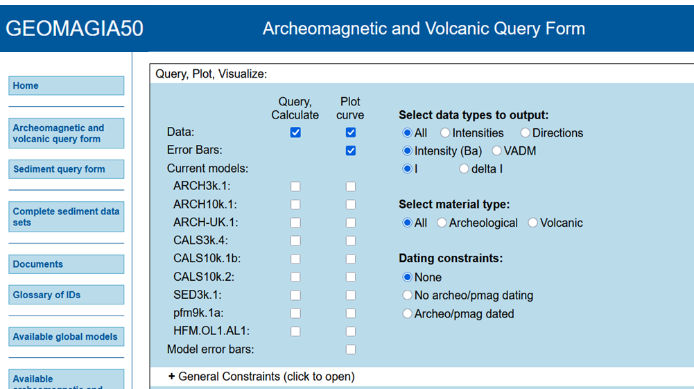
GEOMAGIA50 – Paleomagnetic and Chronological Data for the Past 50 Ka
The GEOMAGIA50 database is an international collaboration to provide easy access to published archeomagnetic/volcanic and sediment paleomagnetic and chronological data for the past 50,000 years. GEOMAGIA50 has been funded by the US National Science …
GGF100k - Model that covers the past 100.000 years and it is the longest global reconstruction of the geomagnetic field
GGF100k is a global geomagnetic field model covering the past 100,000 years. It is the first model that provides a global view of the geomagnetic field evolution over an extended period. The model is based on an extensive global dataset of over 100 …

GGFMB - global geomagnetic field reconstruction for the period between 900,000 and 700,000 years
GGFMB is a global geomagnetic field reconstruction for the period between 900,000 and 700,000 years ago. It includes, in particular, the last complete field reversal approximately 780,000 years ago, the transition from the Matuyama chron with revers…

GIPP | Geophysical Instrument Pool Potsdam
The "Geophysical Instrument Pool Potsdam (GIPP)" by GFZ provides seismic, magnetotelluric and geodetic instruments and sensors for projects of GFZ groups, universities and other research facilities. It is hosted by Section 2.2 | Geophysical Imaging …
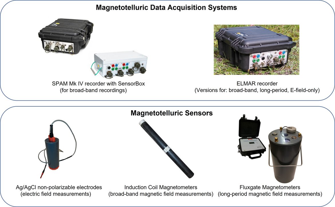
GIPP-MT - Magnetotelluric component of the "Geophysical Instrument Pool Potsdam"
The magnetotelluric instruments are part of the "Geophysical Instrument Pool Potsdam (GIPP)" which means that the instruments are generally available for academic use to all German Universities. The allocation of the instruments is decided by the GF…
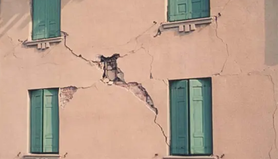
German Earthquake Zonation Map (German Building Code DIN EN 1998-1/NA-2011-01)
Service for assigning of localities in Germany (based on names or zip code) to seismic zones according to the earthquake resistant German Building Code DIN EN 1998-1/NA:2011-01, zonation map (former DIN 4149:2005-04) (only available in German and fo…
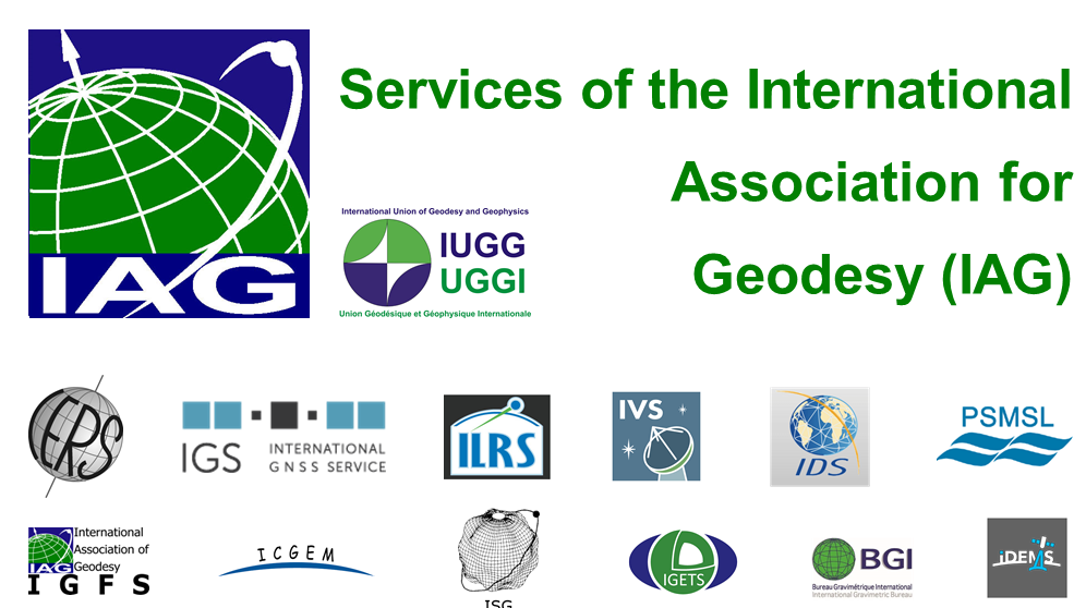
IAG Services - Services of the International Association of Geodesy (IAG Services)
The International Association of Geodesy (IAG) is the scientific organization in the field of geodesy. It promotes scientific cooperation and research in geodesy on a global scale and contributes to it through its various research bodies. It is a me…
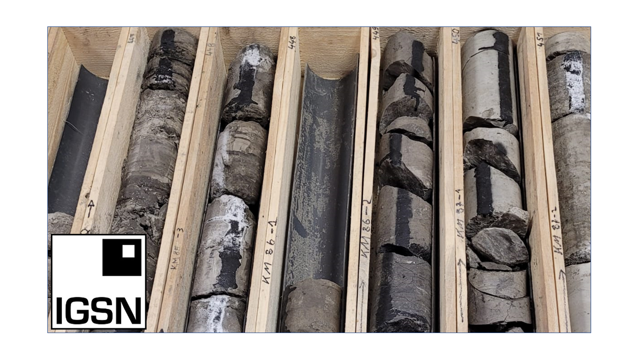
ICDP International Continental Scientific Drilling Programme
The International Continental Scientific Drilling Program (ICDP) is a multinational program to further and fund geosciences in the field of Continental Scientific Drilling. Scientific drilling is a critical tool in understanding of Earth processes a…
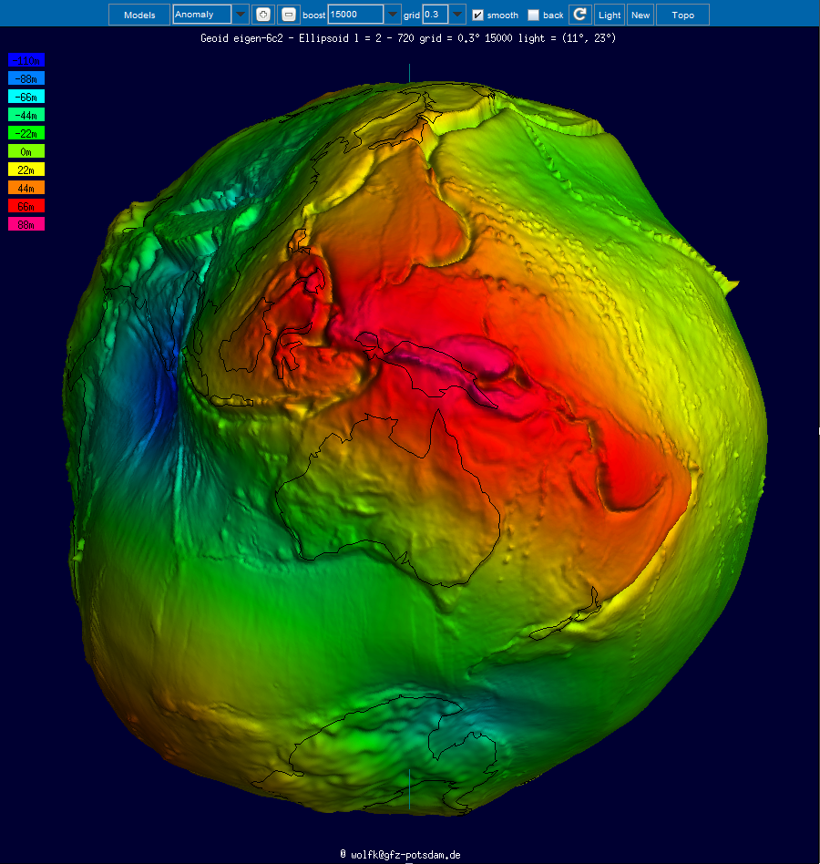
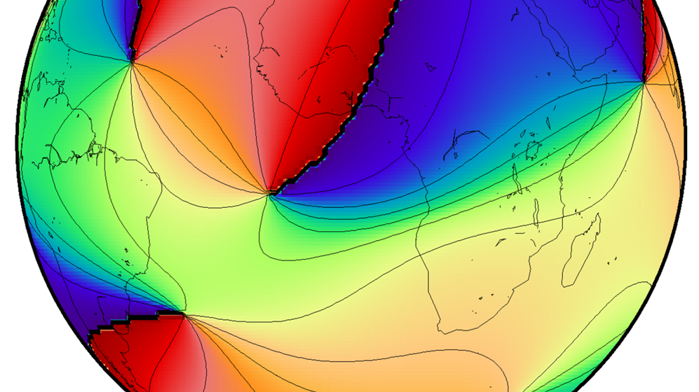
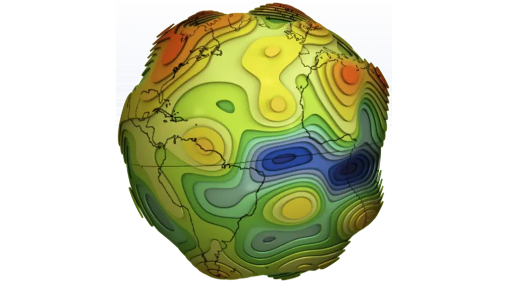
ICGEM - International Centre for Global Earth Models
The determination of Earth’s global gravity field is one of the main tasks of geodesy: it serves as a reference for geodesy itself and provides essential information about the Earth, its interior and its fluid envelope for all geosciences. Thus, it …

IERS - International Earth Rotation and Reference Systems Service
The International Earth Rotation and Reference Systems Service (IERS) was established in 1987 by the International Astronomical Union and the International Union of Geodesy and Geophysics. The primary objectives of the IERS are to serve the astronom…
IGETS Database - Database of the International Geodynamics and Earth Tide Service
The International Geodynamics and Earth Tide Service (IGETS) is one of five services coordinated by the International Gravity Field Service (IFGS) of the International Association of Geodesy (IAG). The main objective of IGETS is to monitor temporal …
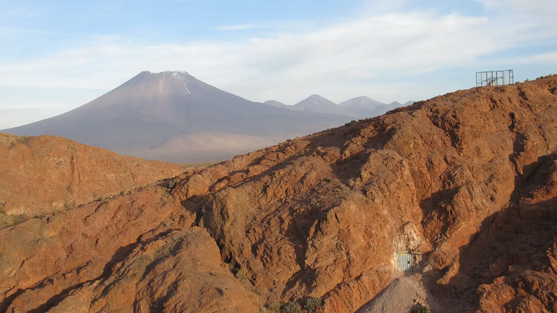
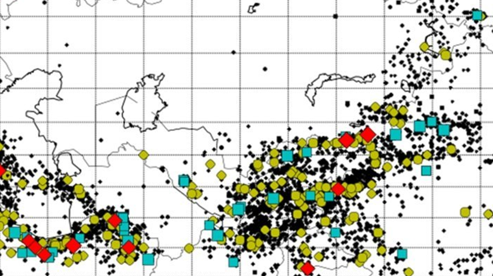
IPOC - Integrated Plate Boundary Observatory Chile
IPOC is an international network of institutions and scientists organising and operating a distributed system of instruments and projects dedicated to the study of the subduction system, its role in landscape evolution, and associated geohazards at …
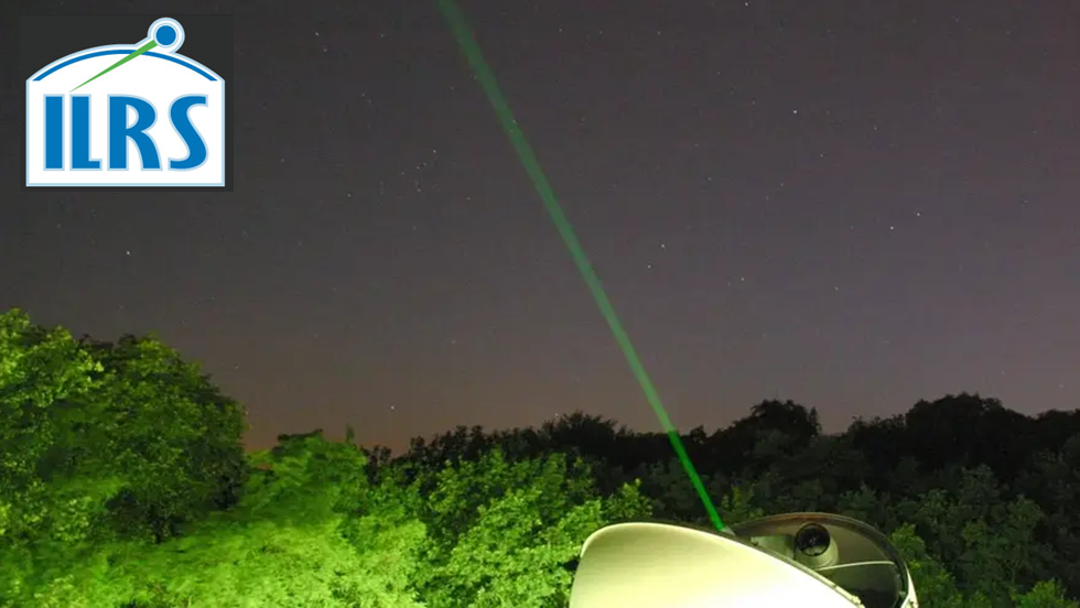
IVS - International VLBI Service for Geodesy and Astronomy
Very Long Baseline Interferometry (VLBI) is a highly accurate technique, used since the 1970s in geodesy that has delivered groundbreaking scientific discoveries. This technique allows scientists to measure global distances with millimeter accuracy;…
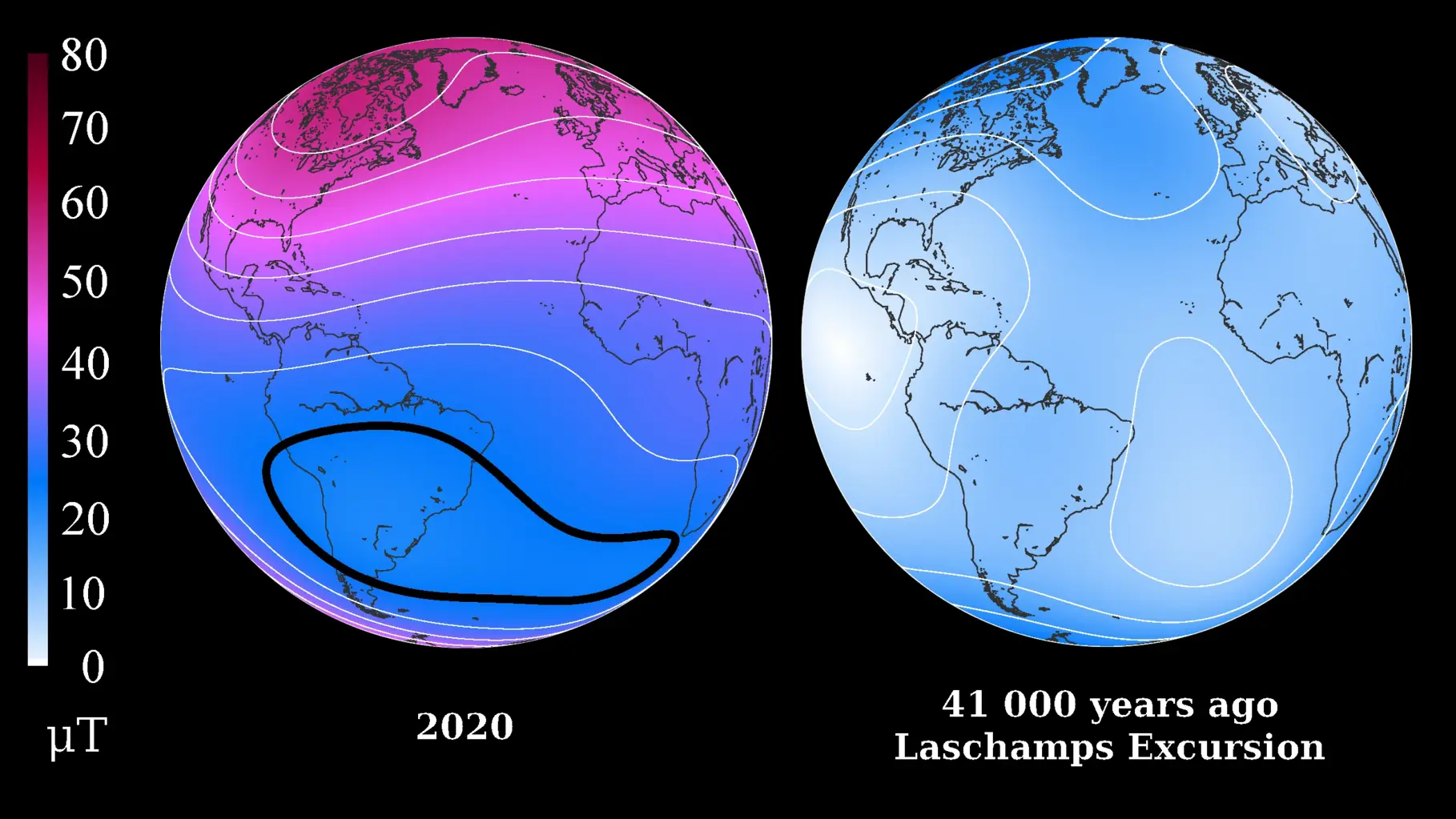
LSMOD Models - Models for the periode of 30 to 50 kyrs that contain the Laschamp and Mono Lake field excursions
Geomagnetic field models for the periode of 30 to 50 kyrs that contain the Laschamp and Mono Lake field excursions. The LSMOD models (current version LSMOD.2) represent the global evolution of the geomagnetic field for the time interval 50 to 30 ka.…
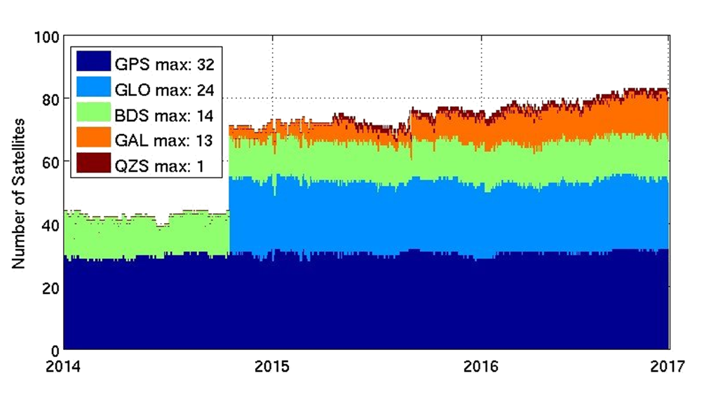
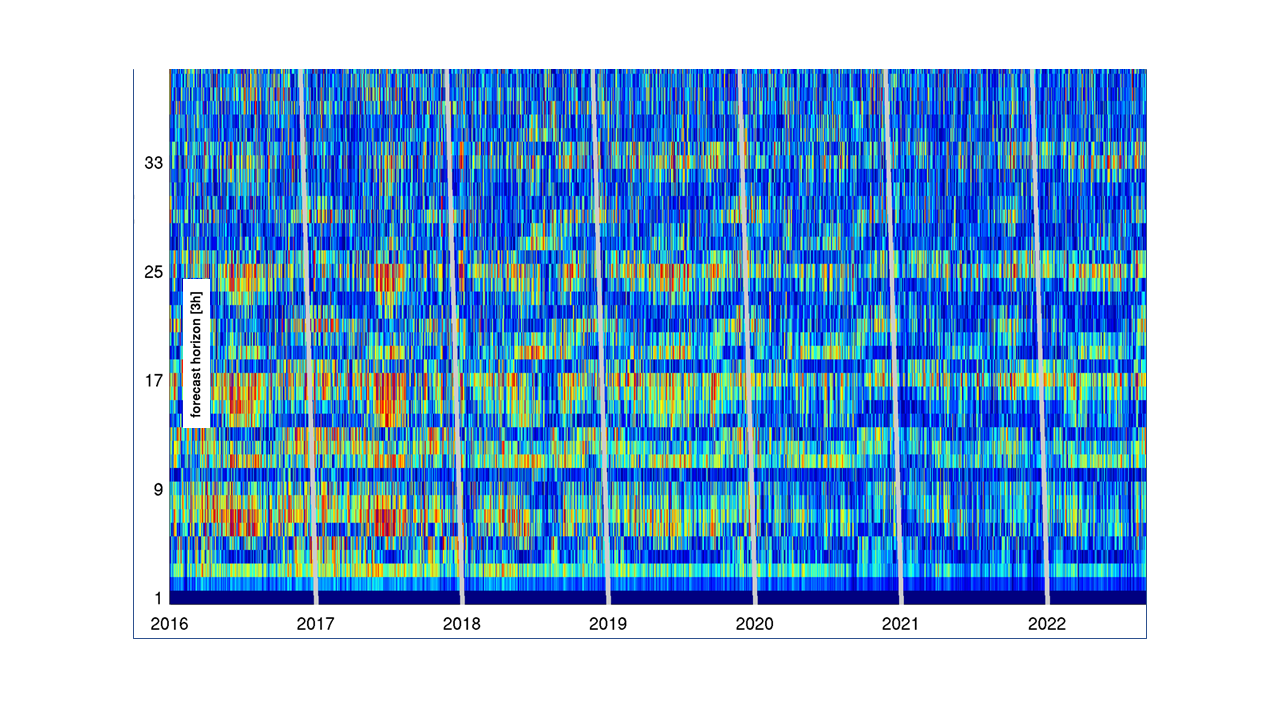
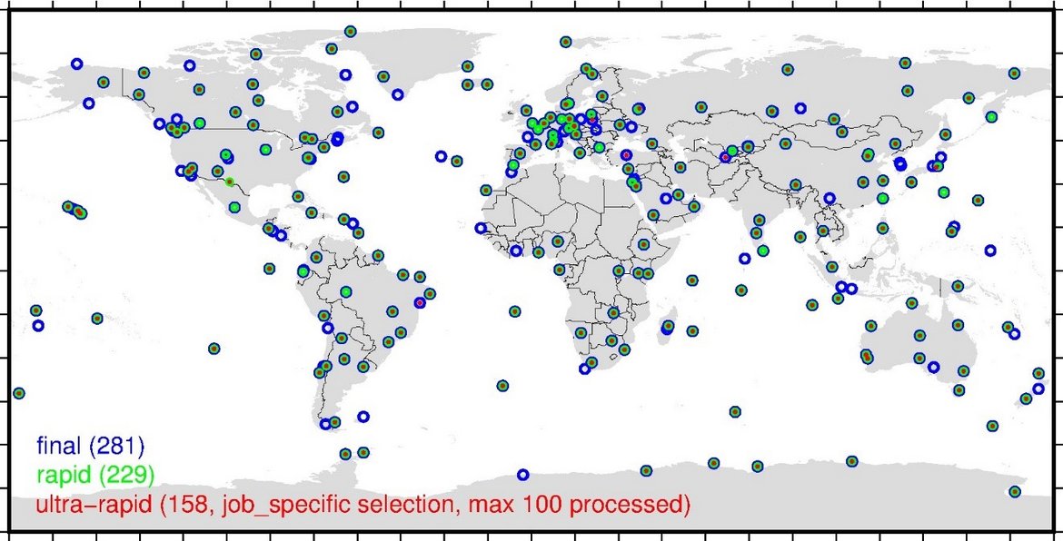
MGEX - Analysis Center of the Multi-GNSS Experiment
The Multi GNSS Experiment (MGEX) was initiated by the IGS in 2012. In MGEX all available signals of the new GNSS satellites are analysed. Currently, seven IGS analysis centers generate consistent and precise orbits and clock corrections of the new s…
Mag.num - Model of the geomagnetic core field, based on satellite and observatory data
Mag.num models are the series of recent GFZ high-precision geomagnetic core field models that rely on satellite magnetic field measurements, in particular on calibrated Swarm and CHAMP vector field and ground observatory data. The coefficients of th…
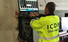
OSG ICDP | Operational Support Group of the International Continental Scientific Drilling Program
The Operational Support Group of the International Continental Scientific Drilling Program, ICDP, situated at GFZ, provides downhole logging services and access to utilize the ICDP instrument pool for PIs of successful ICDP proposals. ICDP is a prop…
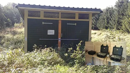
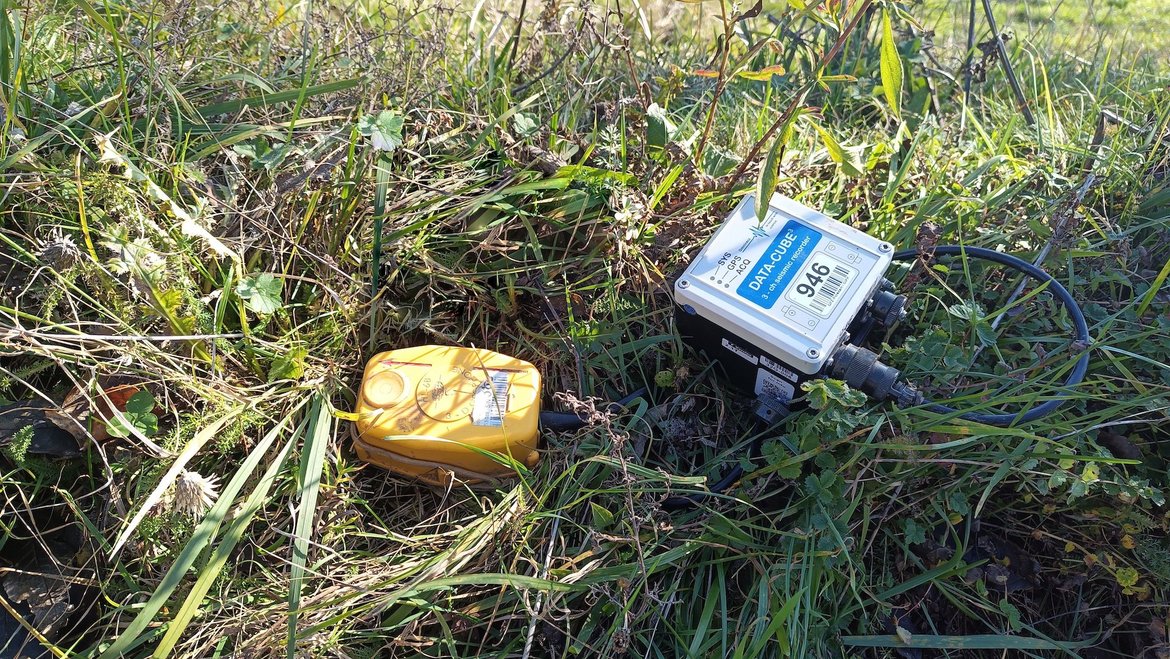
Permanent Magnetotelluric Reference Station in Wittstock, Germany
The sources for the magnetotelluric (MT) method are naturally occurring electromagnetic field variations. Electromagnetic currents are excited over a wide frequency range in the earth’s ionosphere by solar activity and global lighting discharges. Wh…
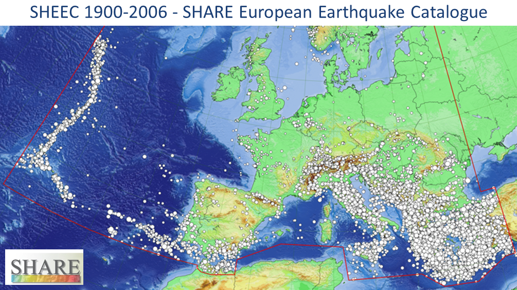
SHEEC - the SHARE European Earthquake Catalogue 1900-2006
The SHARE European Earthquake Catalogue (SHEEC) 1900-2006 has been compiled by GFZ Potsdam in the frame of an independant project and represents a temporal and spatial excerpt of "The European-Mediterranean Earthquake Catalogue" (EMEC) for the last …
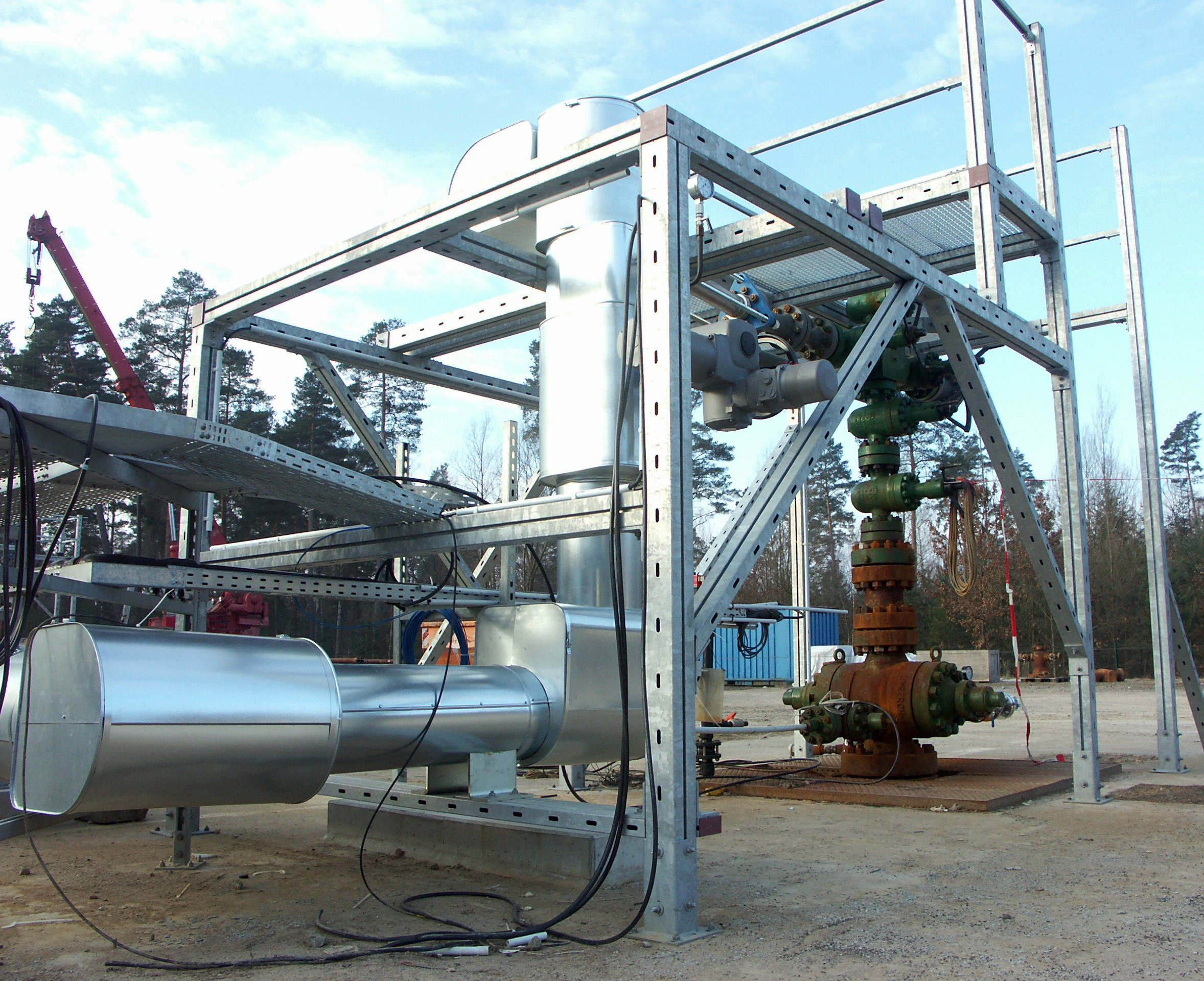
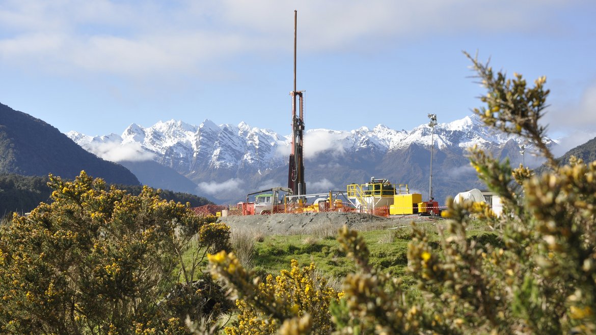
SMARTIES - Supercritical fluids and MAgma Reconnaissance for Transformative Iceland Energy Solutions
Recognizing that the exploration and harnessing of magmatic and geothermal reservoirs involves many disciplines, the mission of “SMARTIES” is to implement a long-term observatory facility together with episodic field experiments for defining, testin…

TERENO NE - Northeastern German Lowland Observatory
The Northeastern German Lowland observatory (TERENO-Northeast) is part of the Helmholtz Association`s interdisciplinary, long-term research network of Terrestrial Environmental Observatories - TERENO representing typical landscapes in Central Europ…
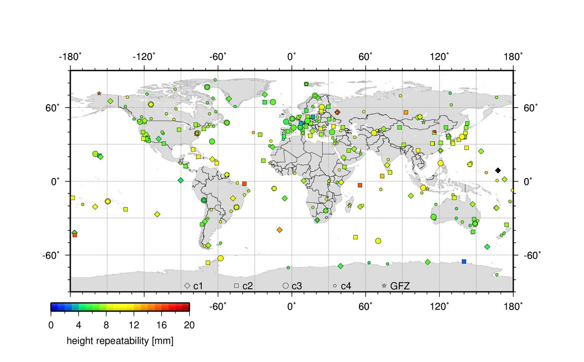
TIGA - Processing Center of the Tide Gauge Benchmark Monitoring Working Group
Being a modern geodetic measuring method, GNSS (Global Navigation Satellite Systems) has reached an important role in geosciences. Within the scope of the Tide Gauge Benchmark Monitoring Working Group (TIGA-WG) of the IGS, GFZ analyses and reprocess…