
Search filter
Clear filters
-
- GFZ
- Department 1 Geodesy
- Section 1.1 Space Geodetic Techniques
- Section 1.2 Global Geomonitoring and Gravity Field
- Section 1.3 Earth System Modelling
- Section 1.4 Remote Sensing and Geoinformatics
- Section 1.5 Space Physics and Space Weather
- Department 2 Geophysics
- Section 2.1 Physics of Earthquakes and Volcanoes
- Section 2.2 Geophysical Imaging
- Section 2.3 Geomagnetism
- Department 4 Geosystems
- Section 4.1 Lithosphere Dynamics
- Section 4.2 Geomechanics and Scientific Drilling
- Section 4.4 Hydrology
- Section 4.6 Geomorphology
-
- Biogesciences
- Earth System Modelling
- GNSS
- Geodesy and Gravity
- Geomagnetism
- Geomagnetism and Paleomagnetism
- Geosciences
- Global Change
- Gravimetry
- Hydrology
- Hyperspectral Remote Sensing
- Informatics
- Meteorology
- Natural Hazards
- Radio Occultation
- Radio Science
- Remote Sensing
- Satellite Laser Ranging
- Seismology
- Space Geodesy
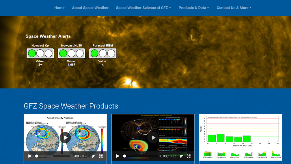
- Space Weather
- Superconducting Gravimetry
- Interdisciplinary
- Biology/Ecosystems Science
- Biogeochemistry
- Geology
- Geomorphology
- Laboratory Keywords
- Analytical Methods
- Earth Remote Sensing Instruments
- Passive Remote Sensing
- Spectroradiometry
- In Situ/Laboratory Instruments
- Photon/Optical Detectors
- UV-VIS-NIR Spectrophotometry
- Spectrometers/Radiometers
- Fourier Transform Infrared Spectroscopy
- X-Ray Fluorescence Spectroscopy
-
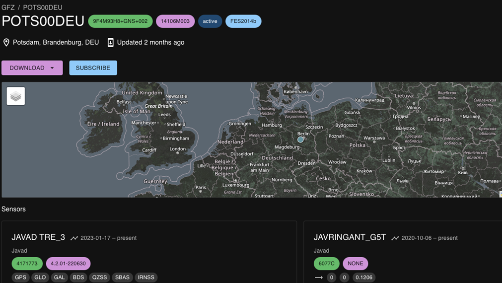
- Continuous GNSS Data
- Continuous GNSS Derived Products
- Controlled Source Seismological Data
- Earth Orientation Parameters
- Final Products
- GIS
- GNSS Data
- GNSS Station and Satellite Metadata
- Geomagnetic index
- Global Gravitational Models
- Model
- Observation Data and Derived Products for the Global Navigation Satellite Systems (GNSS)
- Passive Seismological Data
- Polar Motion
- Precession/Nutation
- Precise Station Coordinates
- Processed GPS Products
- Rapid Products
- Raw Gravity and Local Pressure Records and Products
- Satellite Clock Corrections
- Satellite Data
- Satellite Orbits
- Temporal Models
- Topography Related Models
- Ultra-rapid Products
- Universal Time
Department 1 Geodesy
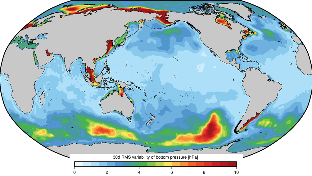
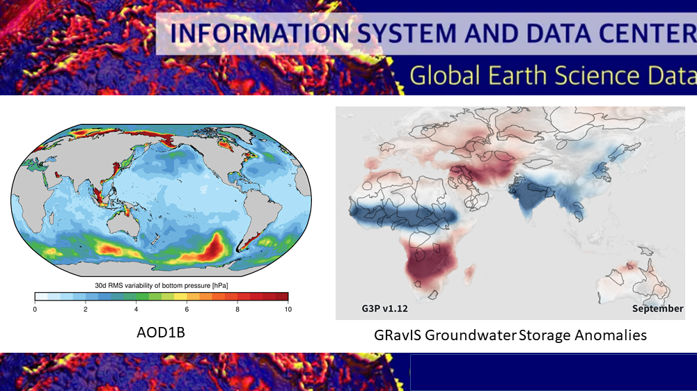
AOD1B - GRACE Atmosphere and Ocean De-Aliasing Level 1B Product
The Atmosphere and Ocean De-Aliasing Level-1B (AOD1B) Product provides a priori information about temporal variations in the Earth's gravity field due to global mass variability in the Atmosphere and ocean. It is based on analysis and forecast data …
Atmospheric and Hydrospheric Surface Loading Deformations
GFZ provides surface loading products including vertical and horizontal deformations of the crust imposed by surface loading of geophysical fluids in Atmosphere, oceans, and the continental hydrosphere. Products are provided with a spatial resolutio…
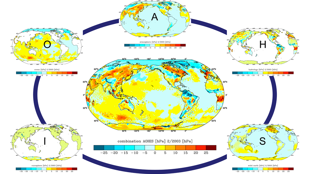
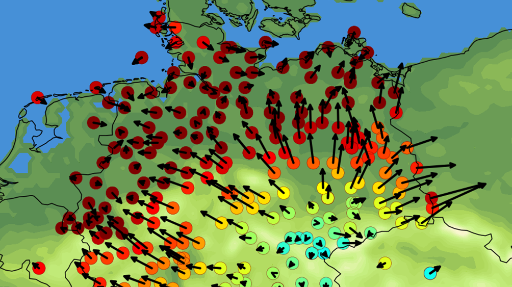
EAM - Atmospheric and Hydrospheric Earth Rotation Excitations
The GFZ contributes to the Global Geophysical Fluid Center (GGFC) of the International Earth Rotation and Reference Systems Service (IERS) by providing matter and motion terms of effective angular momentum functions (EAM). EAMs are due to mass trans…
ESA ESM - the updated ESA Earth System Model for Gravity Mission Simulation Studies
The ESA ESM is a synthetic model of the time-variable gravity field of the Earth suitable for satellite gravity mission simulation studies. The model is an update of the ESA Earth System Model as described by Gruber et al. (2011), and is also given …
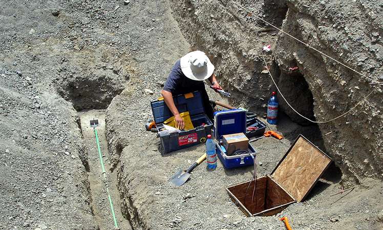
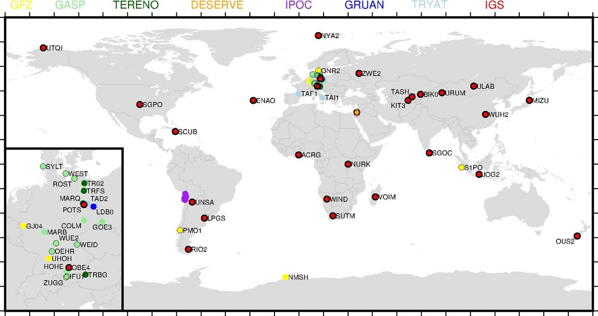
Earth System Observatories (Regional Observatories)
Our observatories are a key instrument for a comprehensive understanding of the system Earth. The combination of monitoring programmes and observatories allows for an observation of the processes shaping the Earth system from a local to a global sca…

EnMAP - Scientific support of the hyperspectral satellite mission
The Environmental Mapping and Analysis Program (EnMAP) is a German hyperspectral satellite mission that monitors and characterizes the Earth’s environment on a global scale. The primary goal of EnMAP is to provide accurate diagnostic information on …
GFZRNX - RINEX GNSS Data Conversion and Manipulation Toolbox
GFZRNX is a toolbox designed and created for the needs of the GNSS community. It supports RINEX observation, navigation and meteorological data. The major tasks include checking, repairing and manipulating (sampling, selection of satellite systems a…
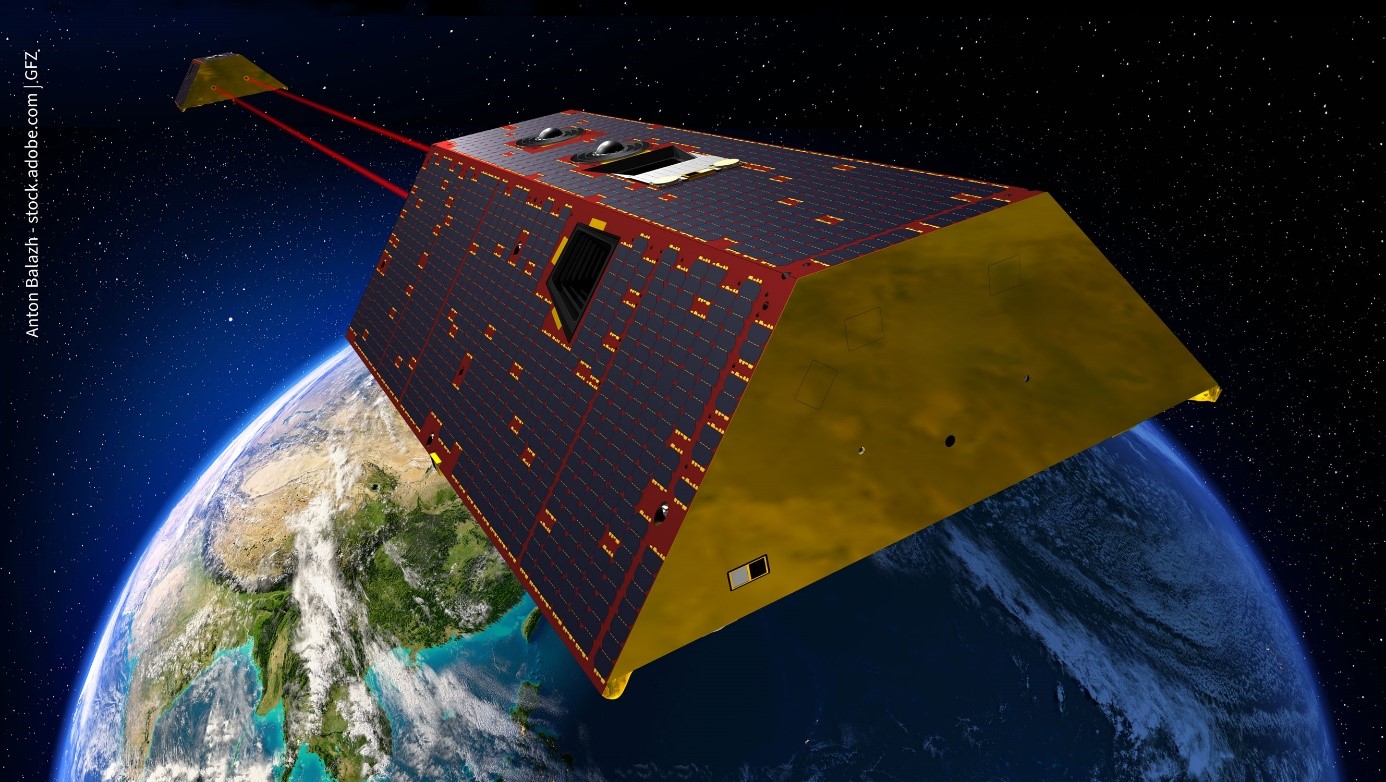
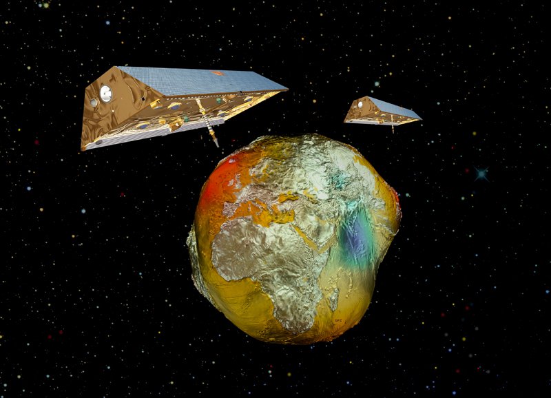
GRACE-C - Gravity Recovery and Climate Experiment Continuation Mission
The primary objective of the GRACE-C Mission is, as for GRACE and GRACE-FO, to obtain precise global and high-resolution models for both the static and the time variable components of the Earth's gravity field. As in the original GRACE missions, thi…
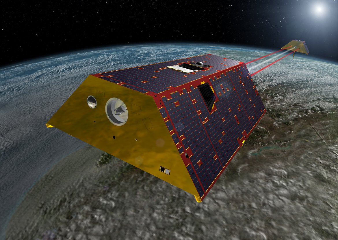
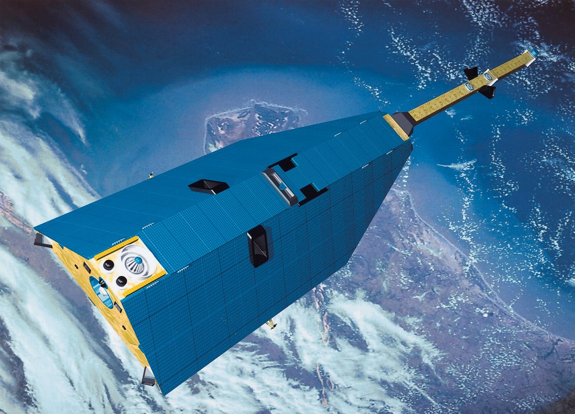
GRACE-FO - Gravity Recovery and Climate Experiment-Follow-On Mission
The primary objective of the GRACE-FO Mission is, as for GRACE, to obtain precise global and high-resolution models for both the static and the time variable components of the Earth's gravity field. As in the original GRACE mission, this goal is ach…
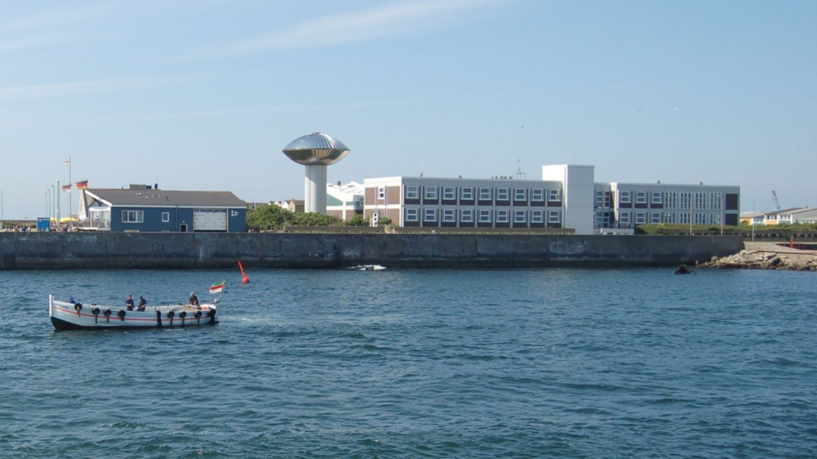
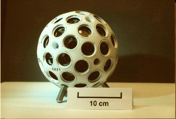
HELGOG - Helgoland Gravimetric Observatory Germany
The Helgoland Gravimetric Observatory Germany (HELGOG) was established in March 2020 in the basement of the Biologische Anstalt Helgoland (BAH) of the Alfred Wegener Institute AWI, Helmholtz Centre for Polar and Marine Research. The main research fo…
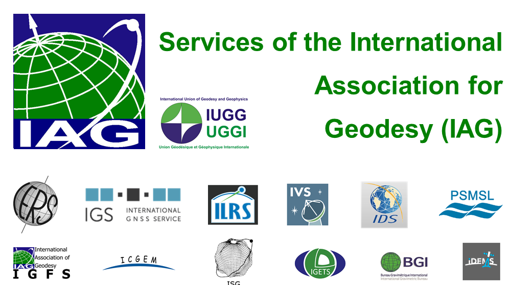
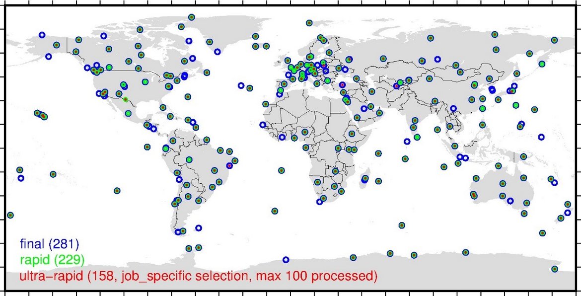
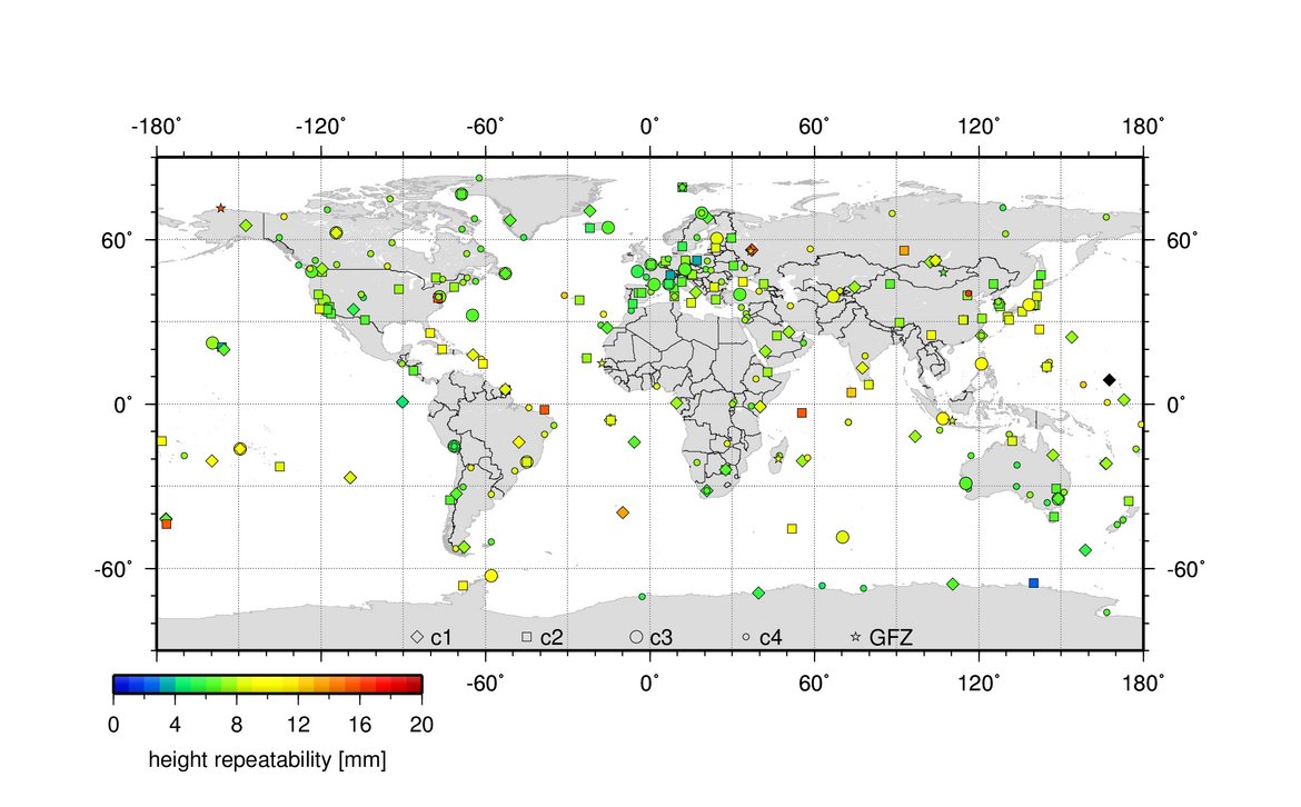
IAG Services - Services of the International Association of Geodesy (IAG Services)
The International Association of Geodesy (IAG) is the scientific organization in the field of geodesy. It promotes scientific cooperation and research in geodesy on a global scale and contributes to it through its various research bodies. It is a me…
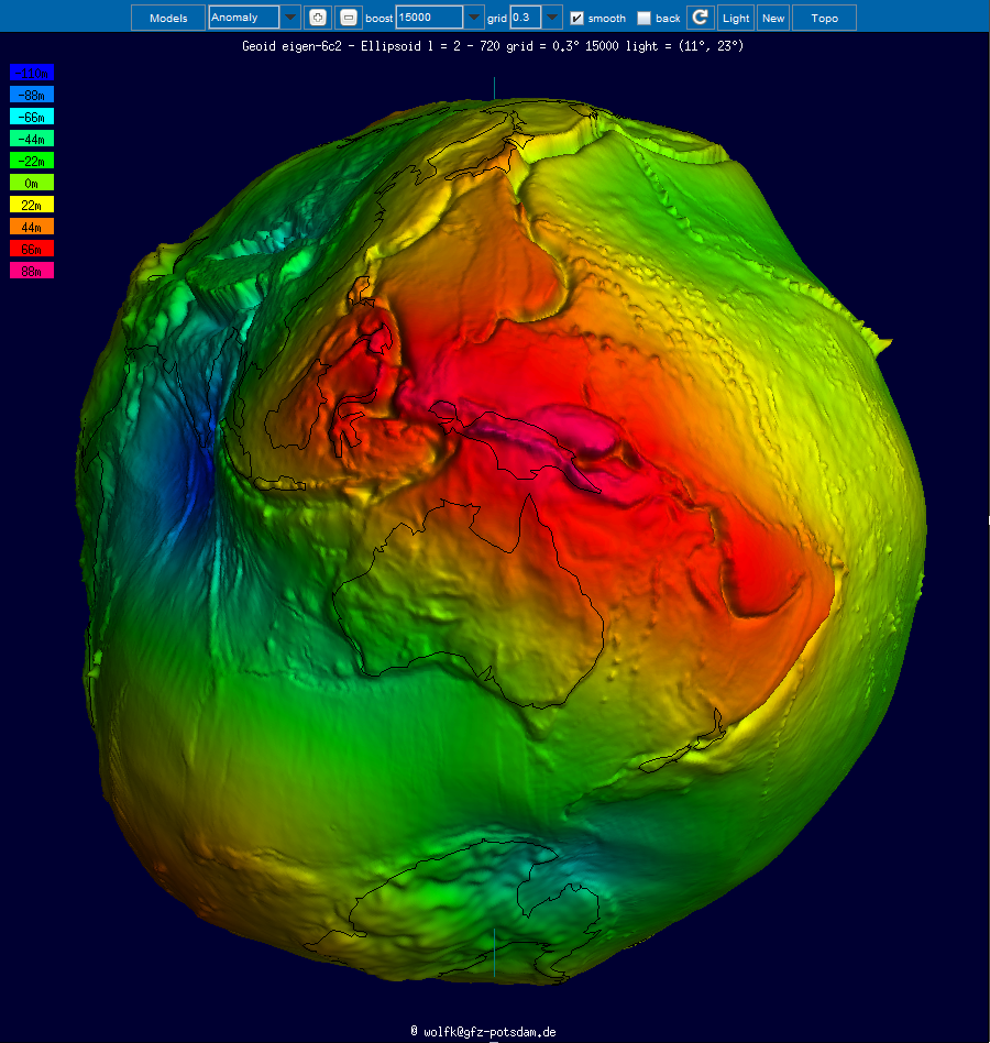
ICGEM - International Centre for Global Earth Models
The determination of Earth’s global gravity field is one of the main tasks of geodesy: it serves as a reference for geodesy itself and provides essential information about the Earth, its interior and its fluid envelope for all geosciences. Thus, it …

IERS - International Earth Rotation and Reference Systems Service
The International Earth Rotation and Reference Systems Service (IERS) was established in 1987 by the International Astronomical Union and the International Union of Geodesy and Geophysics. The primary objectives of the IERS are to serve the astronom…
IGETS Database - Database of the International Geodynamics and Earth Tide Service
The International Geodynamics and Earth Tide Service (IGETS) is one of five services coordinated by the International Gravity Field Service (IFGS) of the International Association of Geodesy (IAG). The main objective of IGETS is to monitor temporal …
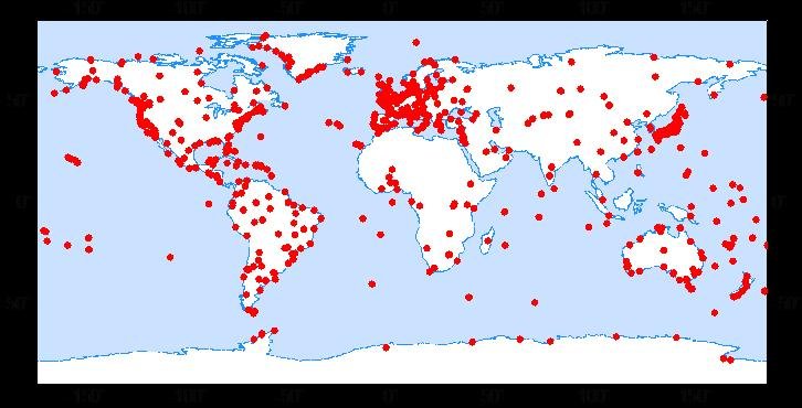
IVS - International VLBI Service for Geodesy and Astronomy
Very Long Baseline Interferometry (VLBI) is a highly accurate technique, used since the 1970s in geodesy that has delivered groundbreaking scientific discoveries. This technique allows scientists to measure global distances with millimeter accuracy;…
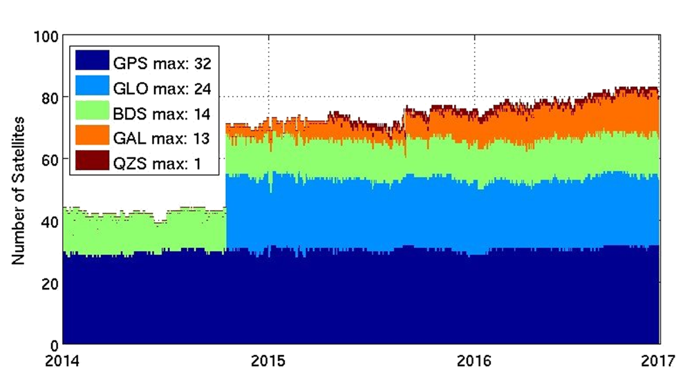
MGEX - Analysis Center of the Multi-GNSS Experiment
The Multi GNSS Experiment (MGEX) was initiated by the IGS in 2012. In MGEX all available signals of the new GNSS satellites are analysed. Currently, seven IGS analysis centers generate consistent and precise orbits and clock corrections of the new s…
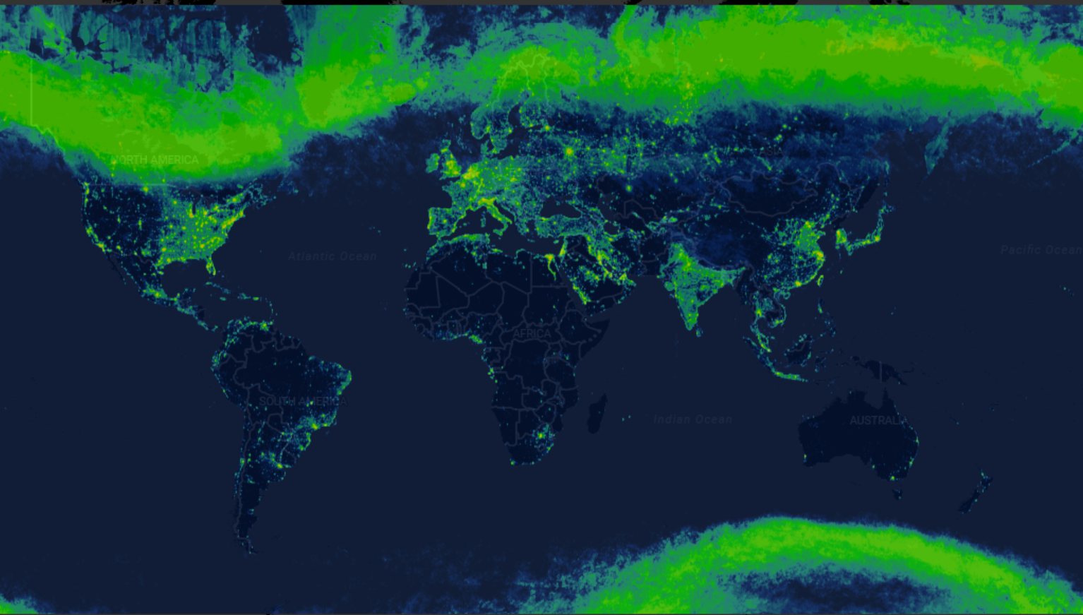
Radiance Light Trends
Radiance Light Trends is a GIS web application that is designed to quickly display information about radiance trends at a specific location (available online at https://lighttrends.lightpollutionmap.info). It uses data from two satellite systems, DM…
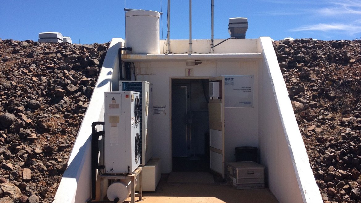
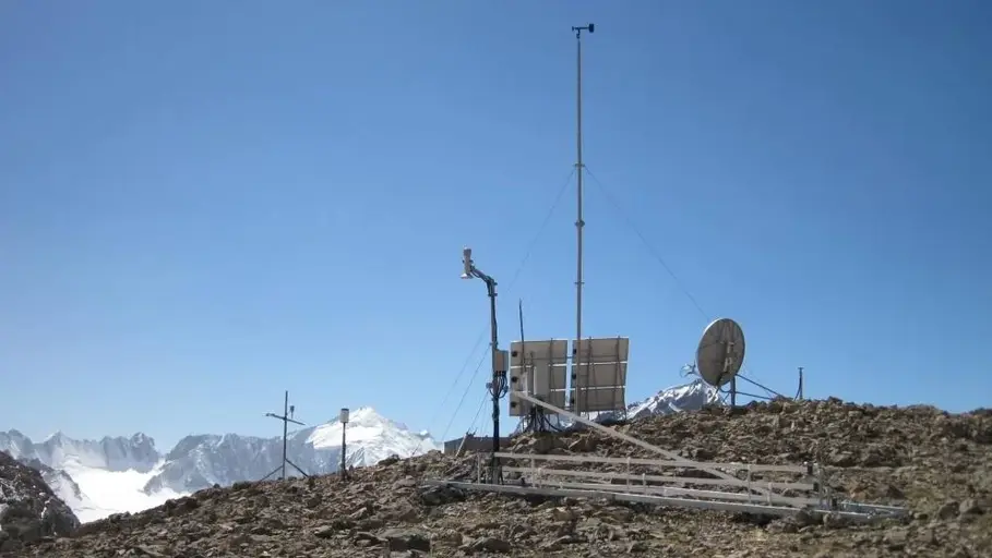
SAGOS - South African Geodynamic Observatory Sutherland
The South African Geodynamic Observatory Sutherland (SAGOS) of GFZ was established during the years 1998 – 2000 based on an Agreement on Cooperative Activities between the National Research Foundation (NRF) and GFZ, signed in August 1998. SAGOS is l…
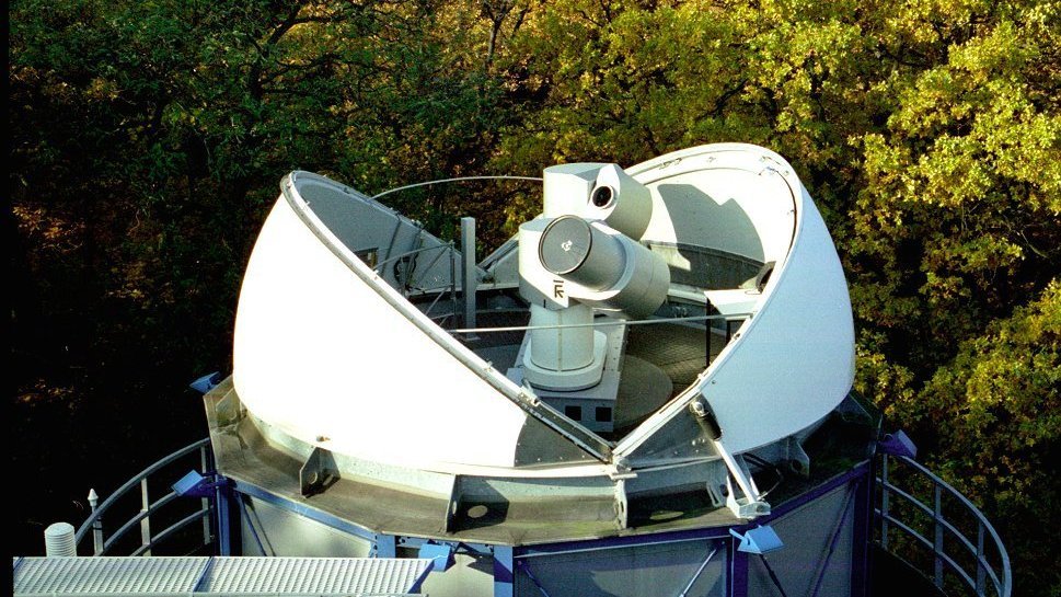

Satellite Receiving Station Ny-Ålesund (Spitsbergen)
The GFZ Helmholtz Centre for Geosciences operates a satellite receiving station at Ny-Ålesund, Spitsbergen (78° 55´ North, 11° 56´ East) to receive data from research satellites in polar orbits. The station is located about 1 km outside the village,…

TERENO-NE - Northeastern German Lowland Observatory
The Northeastern German Lowland observatory (TERENO-Northeast) is part of the Helmholtz Association`s interdisciplinary, long-term research network of Terrestrial Environmental Observatories - TERENO representing typical landscapes in Central Europ…
TIGA - Processing Center of the Tide Gauge Benchmark Monitoring Working Group
Being a modern geodetic measuring method, GNSS (Global Navigation Satellite Systems) has reached an important role in geosciences. Within the scope of the Tide Gauge Benchmark Monitoring Working Group (TIGA-WG) of the IGS, GFZ analyses and reprocess…

CHAMP - CHAllenging Minisatellite Payload inactive
CHAMP (CHAllenging Minisatellite Payload) was a German small satellite mission for geoscientific and atmospheric research and applications, managed by GFZ. With its highly precise, multifunctional and complementary payload elements (magnetometer, ac…

GOCE - Gravity Field and Steady-State Ocean Circulation Explorer inactive
The Earth explorer satellite GOCE (Gravity Field and Steady-State Ocean Circulation Explorer) was the first satellite mission within the framework of the Living Planet Program of ESA. This satellite mission was mapping the Earth's gravity field on g…
GRACE - Gravity Recovery and Climate Experiment inactive
GRACE was a joint project between the National Aeronautics and Space Administration (NASA) and the Deutsches Zentrum für Luft- und Raumfahrt (DLR). The mission has been proposed in 1996 jointly by the University of Texas at Austin, Center for Space …